On this page:
Gravesend to Burnham On Crouch. May 2026.
Burnham On Crouch to Felixstowe. June 2026.
Levington to Great Yarmouth September 2026.
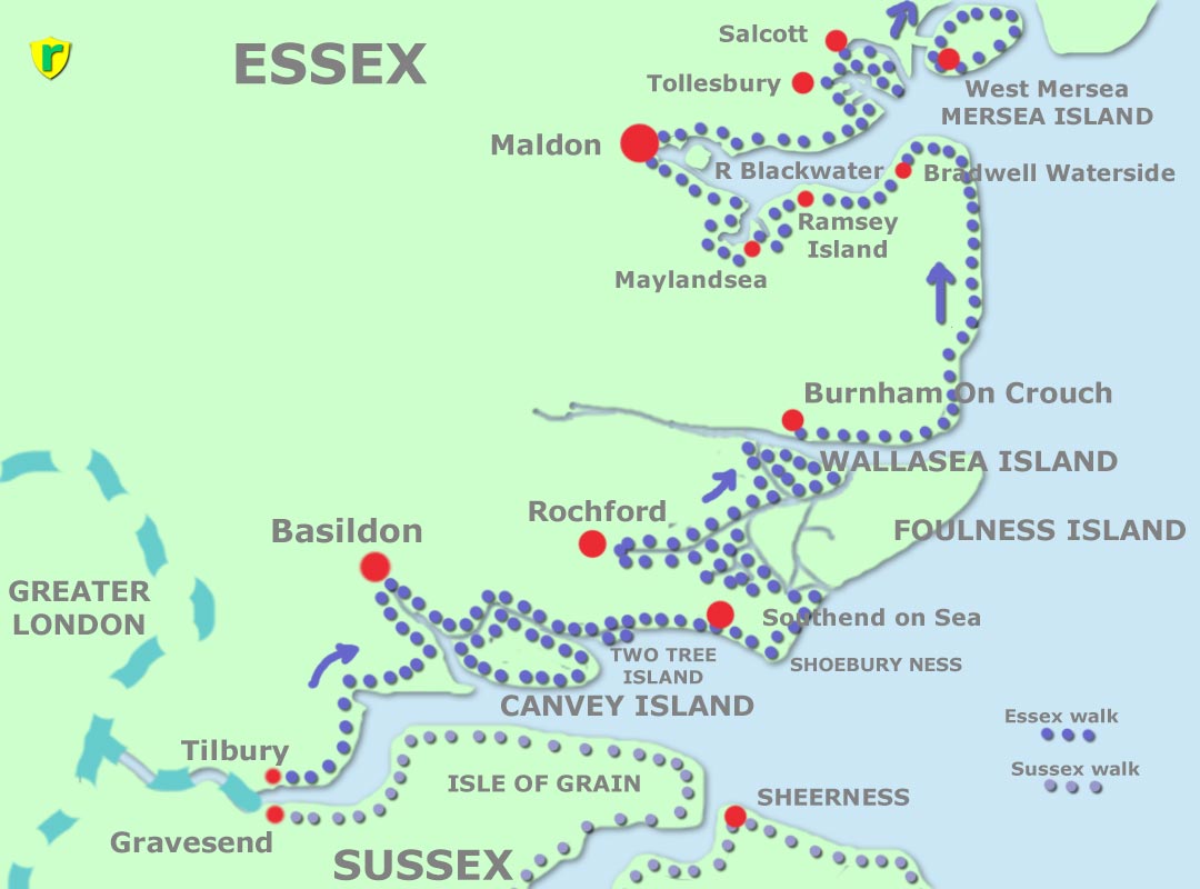
Tilbury, Stanford-Le-Hope, Basildon, Benfleet, Canvey Island, Two Tree Island, Leigh-on-Sea, Southend-on-Sea, Shoebury Ness, Great Wakering, Rochford, Paglesham, Wallasea Island, ferry to Burnham-on-Crouch, Bradwell Waterside, Ramsey Island, Maylandsea, Maldon, Tollesbury, Salcott, Mersea Island. A gap, where no path exists. Then Shotley Gate, Wherstead, Orwell Bridge (Suffolk border), Levington, Felixstowe.
I decided to book accommodation for this trip as the weather was uncertain.
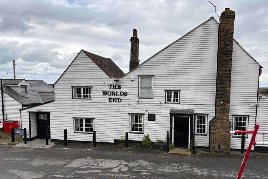
I left Dorset on a sunny Monday morning by train to Waterloo, took the tube to West Ham then a train to Tilbury, where it looked like rain was possible. I walked into the town centre to find out what might be available to me, thinking that I might stop for a snack or a drink but found nothing to my liking. I was too early to book into my accommodation so I decided to take a stroll to see the The World's End pub, which I had read about on the train. I though that it might make a nice photo to start the account of my walk. I didn't realise that Tilbury town was not near Tilbury docks where the pub was, so after walking out of town for a mile or so on the deserted pavements of a large industrial area I found the pub, which was closed, which I should have expected as it was a Monday, but it looked rather run down and I wondered if it was permanently closed. I took a photo and strolled back to the town to find my accommodation which was located at the eastern edge of the town and where I found that there was nowhere nearby to eat. There was a mini-market type shop nearby so bought some supplies to eat at my accommodation and for the next day. I looked up the The World's End on Tripadvisor and the last entry was two months old.
Day 1: From Tilbury to Vange, Basildon.
Walking back to the coast on Tuesday morning I passed the shabby and deserted looking World's End again. From there I began walking along the England Coast Path which was signposted along the top of the sea wall and past Tilbury Fort. Shortly afterwards the path dropped down to run along the concrete path at the bottom of the sea wall on the shoreline side. There was a large notice warning that it could be submerged during high tide, which it was not, so I continued along it.
 |
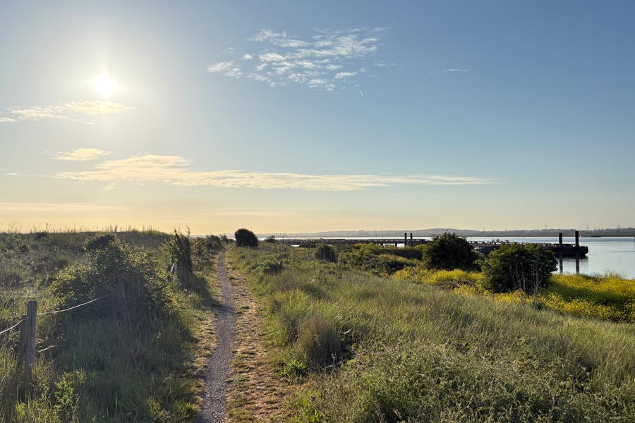 |
| The World's End | East Tilbury marshes |
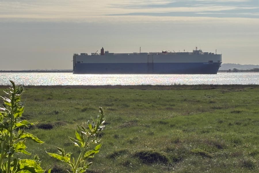
Being out on the marshes was what I was looking forward to. The noise of the traffic had died away and ahead was all I needed, a path, open countryside and a blue sky. There was a cool breeze and a warm sun, Perfect. There was a huge cargo ship gliding slowly and silently up the Thames and all I could hear was the sound of the breeze and the birds, including a cuckoo.
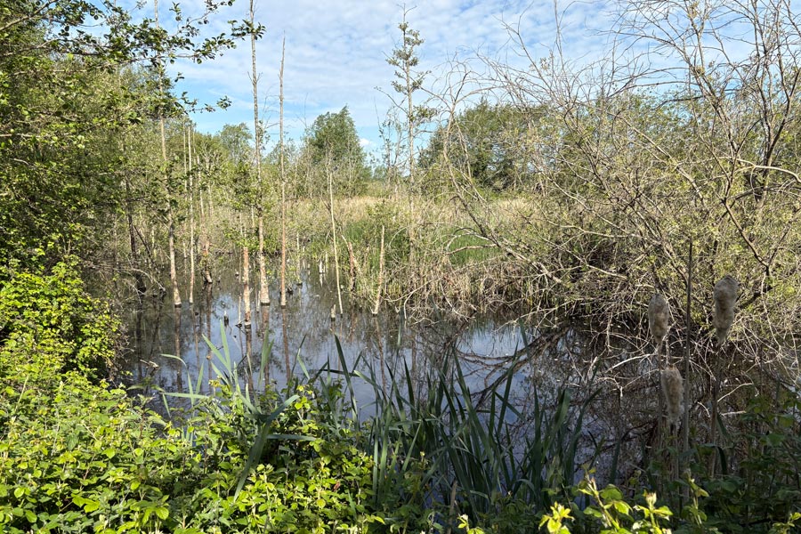
After about 4 miles, at Coalhouse Fort Park, I stopped and had some breakfast, sat in the warm sun at one of the picnic tables there. After that the path turned inland edging around Mucking Marshes and towards Corringham which was about 7 miles away, the path snaking around the edges of the marshes. After a few miles I heard a another cuckoo, or perhaps it was the same one.
 |
 |
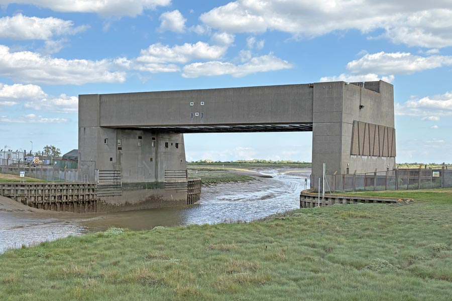
The path bypasses Corringham but as it was lunchtime I diverted from the route and walked half a mile into the village to have lunch and a pint in the Bull Inn. I returned to the path which continued inland and followed alongside of a fast road around the outside of the industrial estate behind the London Gateway Port for nearly 2 miles before leaving the road to pass along the top of the sea defences of Holehaven Creek. Further along, in the middle of nowhere at Fobbing Horse there was a substantial construction called, according to my map, a Movable Flood Barrier which protects the low lying land from high water. I first saw its strange shape on the horizon without seeing the creek below it and that really puzzled me as to what it was.
The path then snaked around the ends of several smaller tributary creeks that feed into Holehaven Creek. Here the path was slow going; it had been trodden by cows; was deeply rutted; and the mud was now rock-hard and partly hidden in the long grass were deep holes. About 4.5 mile further on I passed through the Vange Marsh Nature Reserve where I used the foot tunnel that the route took to pass beneath the railway line and then another foot tunnel under the A13 that took me to the edge of the Vange area of Basildon, where my accommodation was. Similar to the night before I found nowhere suitable within walking distance to get a meal so I bought a pasty at a mini-market and a bottle of beer at the large booze shop next to it. I returned to my room, ate my simple meal, listened to a talking book on my phone for an hour and had another early night.
End of day 1: About 18 miles of the path walked today.
Day 2: Vange to Canvey Island.
Early next day I returned through the foot tunnel under the A13 and rejoined the onward path through the derelict land that was trapped between the road and the railway line. It then followed the railway line for about 1.5 miles before passing over the line and and heading for Bowers Marshes. It was an overcast day and there was a cold wind blowing. The next two miles were along the edges of the marshes then it passed under the A130 East Haven viaduct to Canvey Island then along the edge of Benfleet Creek. Later the path emerged onto the road near Benfleet railway station. Shortly afterwards I turned right onto the road and foot bridge to Canvey Island.
 |
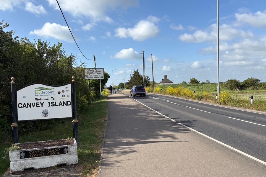 |
| East Haven Creek | Welcome |
I chose to walk the edge of the island in an anticlockwise direction because my accommodation was in the centre of island and I had calculated that my day's walk would be about 17 miles if I walked about three-quarters of the island's coast path before diverting to my hotel. This would also make my next day's walk about 16 miles. The first few miles were very pleasant, through the countryside along the edge of the creeks, even with the cranes of the the London Gateway Port and the oil storage tanks of an oil refinery always on the opposite banks of the wide Holehaven creek. Wide because the tide was now high, which made the expanse of grey water more photographic than the acres of mudflats that it would have been. But the blue sky was now beginning to be replaced by darkening clouds. At the west end of the island was another Movable Flood Barrier, (unless they had moved the one that I saw the day before). Not funny, I know, but the description Movable seemed wrong to me.
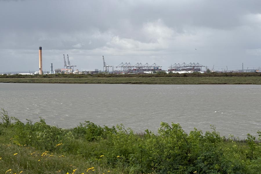 |
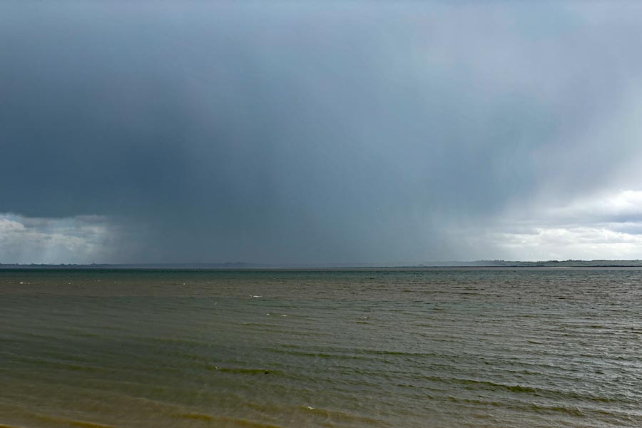 |
| Holehaven Creek | Approaching storm |
When I reached the end of the creek and was back at the Thames. The path, which continued to be along the sea defences, had an oil storage depot on the landward side that was connected to a series of jetties on the shore side by caged gantries carrying pipes, which the path, now hemmed in by wire fences, had to periodically drop down to pass beneath the gantries. I had noticed that approaching from the south west were dark clouds, already dropping curtains of rain beneath them but I left it to the last minute to put my waterproofs on as I was already quite hot. When the rain hit it was torrential and I was soon being battered with hailstones as well. I was up on the sea wall with no cover and no way to get off so I had to keep going. By the time I got to Thorney Bay the storm had passed on ahead of me, so I stripped off my rain-gear and came to a nice cafe overlooking the bay.
After two very substantial bacon and brie ciabatta rolls and a salad I rested with my large coffee for a while. Then I continued on along the sea wall towards the eastern end of the island. The air was fresh after the storm but looking out over the estuary there was another very visible deluge occurring over other side of the Thames. The weather improved as I walked round the end of the island, through Canvey Heights Country Park, and about halfway along the top (north) of the island I turned towards the town centre and my hotel, the Oysterfleet. In town there was a reasonable choice of eating places but I chose to eat in the bar of the hotel.
End of day 2: About 16 miles of the path walked today.
Day 3: Canvey Island to Shoebury Ness.
The tide was out as I walked out of the town the next day along the side of Benfleet Creek and towards the bridge. After crossing the bridge again, passing a third fllod barrier the path passed through the Benfleet Moorings site and into open countryside. After about 3.5 miles of pleasant walking the bridge onto Two Tree Island appeared. I crossed the bridge and spotted a small picnic area so I sat at a table to have a light snack and a drink before continuing to walk towards the western end of the island. At the end of the island I came to Monty's Lookout, a hide overlooking the Salt Lagoon at the end of the island. I took out my pocket monocular and spotted some oystercatchers.
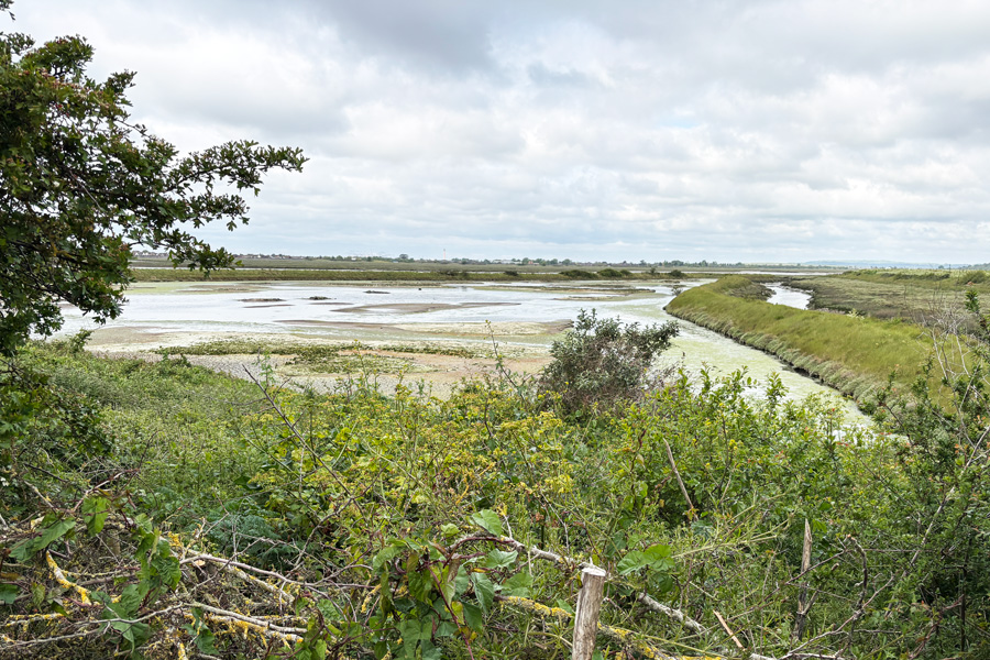 |
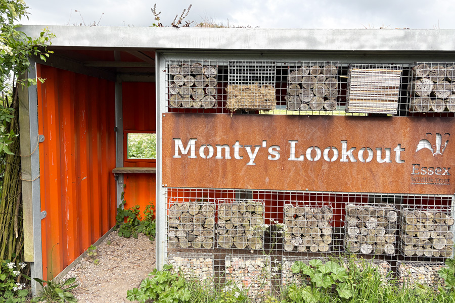 |
| The Salt Lagoon | Monty's Lookout |
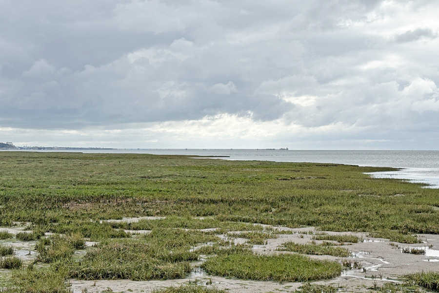
The Island was covered with bushes and small trees and was crisscrossed with paths for walkers of which there were quite a few, mostly with dogs. I walked along the south shore noticing the outline of the mile-long Southend on Sea pier, just visible on the horizon. Back on the mainland I walked along the edge of Hadleigh Marsh and past Hadleigh Railway Station. The path continued to follow the railway on a narrow road with the high fence of the line on one side and a row of cockle sheds on the other side. Very fragrant. Quite nice actually. I nearly stopped to get some at one of the counters but I was intending to have a late breakfast in Southend On Sea. The path progressed along the road through Leigh-On-Sea and past a rapidly receding sandy beach before becoming a narrow path between the railway and the sea for a time before the beach reappeared at Southend On Sea.
 |
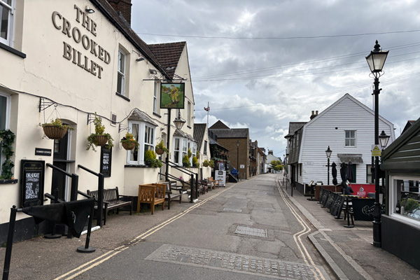 |
| Southend Pier on the horizon | Leigh-On-Sea |
I walked along the promenade for a while and then made my way up the hill into the town. I had been hoping to get a late breakfast at The Last Post but Wetherspoon breakfasts are not served after midday, and it was 12:15 by then, so I had gammon and chips and a pint. I rested for a time, sipping my pint, watching and listening* to the customers and enjoying the ambiance and decor of the building before moving on.
* I don't usually listen to other peoples conversations but the loud voices of the locals as they entered the bar and greeted each other, sometimes seemingly quite rudely, and the banter that was passed between the tables, all in great local accents, was impossible to ignore. It fascinated me.
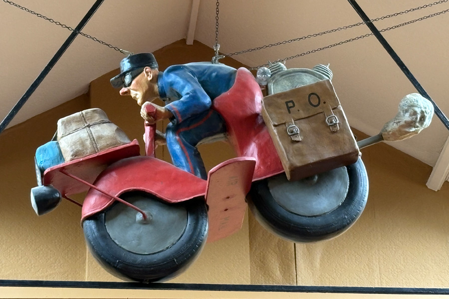
The last Post
When I left The Last Post I found that it was raining, and as I slipped my waterproof jacket on, it stopped. Much refreshed by my lunch break, I strolled down the High Street, looking at the different shops hoping that one of them would jog my memory into remembering something that I had earlier realised that I had forgotten to pack. Nothing came to mind. I made my way down to the sea front near the pier then continued to walk eastwards along Marine Parade towards Shoebury Ness where I had booked an Artsy Minimalist Suite for the night. It was the only accommodation that I could find that was available near the Coast Path.
 |
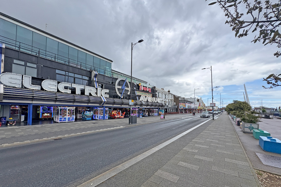 |
| Southend On Sea | Entertainments |
I walked along the promenade past the entertainment establishments, stopping in a small shelter to put my rain gear on when a rain storm nearly caught me out, and strolled on a little more slowly until I was able to remove it again so as not to overheat. I was at my accommodation by 4pm so I dropped off my rucksack and strolled back down to the beach to pass the time and search for somewhere to eat later.
The end of the beach at Shoebury Ness is marked as a military danger area which stretches up the coast, including parts of the land, Potton Island and Foulness Island and out to sea for up to 5 miles. I walked east along the beach as far as I could then around the headland (the ness) and along the coast path for about 2 miles, then returned to my accommodation.
End of day 3: About 17 miles of the coast path walked today.
Day 4: Shoebury Ness to Rochford
I was up early and had a cup of coffee with my host Ellie, who was a charming and helpful host. My room was excellent, not quite 'minimalist' as described as there were lots of decorative items everywhere, but very clean and comfortable. I was walking by 6:30 and was able to start where I had finished my evening stroll the night before. The path was now away from the coast. I walked to Great Wakering where I bought supplies, including a pasty and a big bar of dark chocolate at the mini-market there. Shortly after that the path returned to the coast again at Havengore Creek and began the start of a 13 mile ramble around the edges of four more creeks and the River Roach. There was a bit of confusion just after walking through the boatyard at Mill Head where I found myself entering a 'Danger Area' and after trying some alternatives, decided that it was the correct path after all and continued through it.
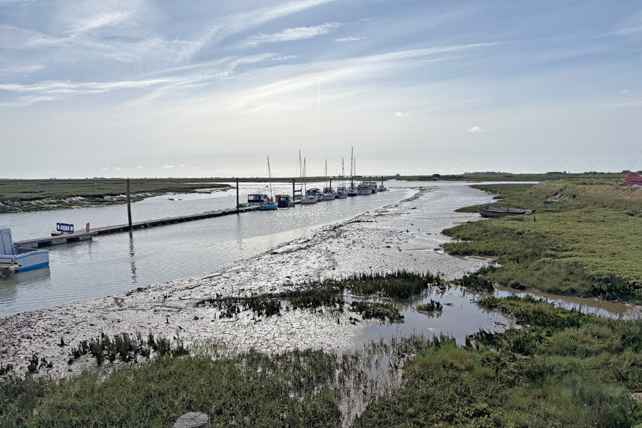
From then on it was excellent open countryside walking. It must have rained shortly before I got to Barlinghall Creek because for a mile or two the long grass was very wet and soaked my trouser legs. Further on the grass was dry and my poly-cotton trousers became quickly dry again. I took several photos of the weak sun shining on the muddy creeks but none were outstanding. The only signs of life were where the path very briefly passed through the outskirts of the village of Barling when it rounded the end of Little Wakering Creek. All of this walking was along the track at the top of the sea defences around the creeks and along the River Roach. I was walking into a pleasantly cool wind.
 |
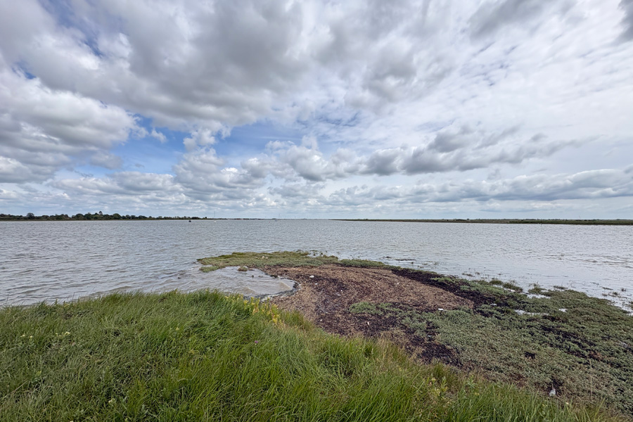 |
| Potton Creek | Baring Ness |
At the outskirts of Rochford the countryside ended and the path then followed a very narrow pavement along Sutton Road. Narrow because of the mass of uncut hedges growing over it. The road was very busy and the traffic was fast, noisy and dusty. I was forced to walk inches away from the traffic that roared past. At a road junction the path then turned north through an industrial area but I carried straight on and walked into the town as I had time to spare before I could book into my accommodation. I had a look around the town, which didn't take long. I couldn't find an open cafe so I bought a large coffee and a big chocolate-chip cookie in Greggs and sat on a bench in the little square enjoying the sun and watching the cars lining up to enter the square and to wait for a parking space to be free. There was an awkward space in the corner of the square that only the brave drivers used. Other drivers saw it but preferred to sit and wait for one to be vacated that didn't require any maneuvering skill.
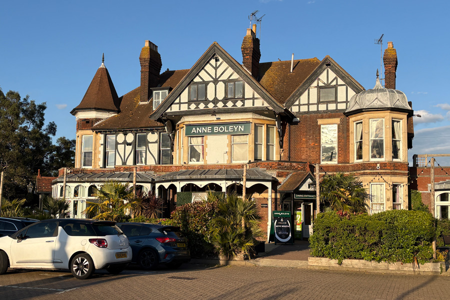
Back at the B&B I had a hot shower and rested, then later crossed the road to the Ann Boleyn where I had a pint, Gammon, chips and peas. Then I relaxed with my pint and watched the antics of the young adults turning up, greeting each other and starting their Saturday night out. Were we that loud?
End of day 4: About 15 miles of the path walked today.
The B&B was well placed for the pub. It was also well placed for London Southend Airport, being at the end of the runway. I knew this when I booked it but the price was right and when I am walking I sleep well anywhere. I was asleep by 10pm but was awoken a little after midnight when my room became filled with bright light together with the sound of a plane landing. I was instantly awake and managed to take a photo of the plane seemingly heading straight at me. I was asleep again five minutes later.
 |
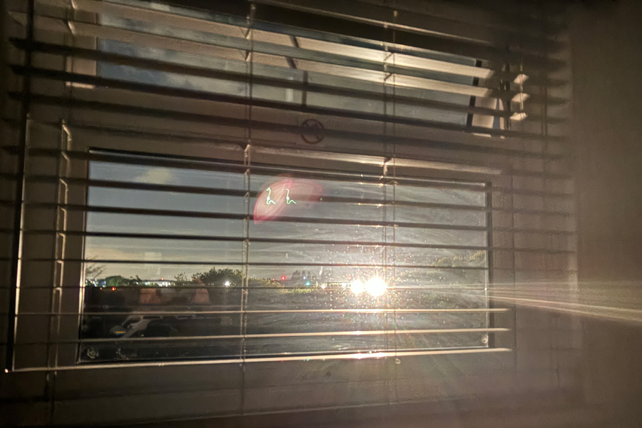 |
| The Anne Boleyn | 00:16 last inbound flight? |
Day 5: Rochford to Burnham On Crouch.
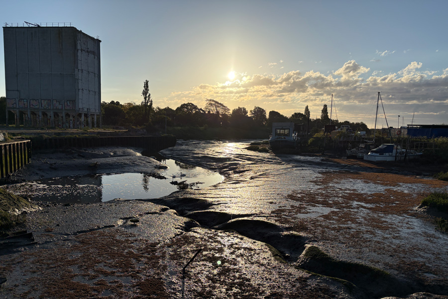
I walked out of town through an industrial estate and then arrived at the other side of the River Roach. The tide was out so I took a picture of the mud shining in the sun. As I walked the tide began to flood in. I was walking with my back to the wind with the the warm morning sun on my face.
 |
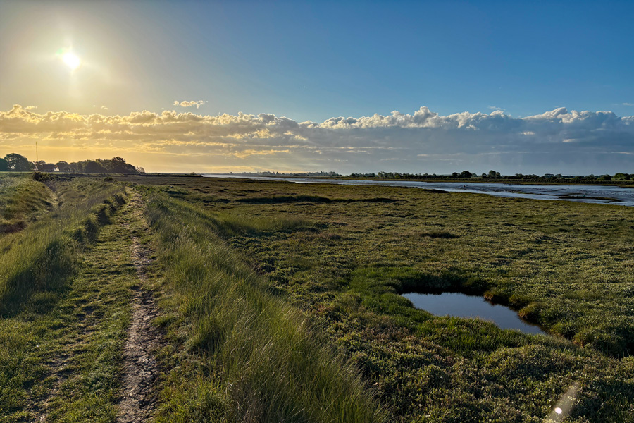 |
| Mud. Lots of it. | River Roach. |
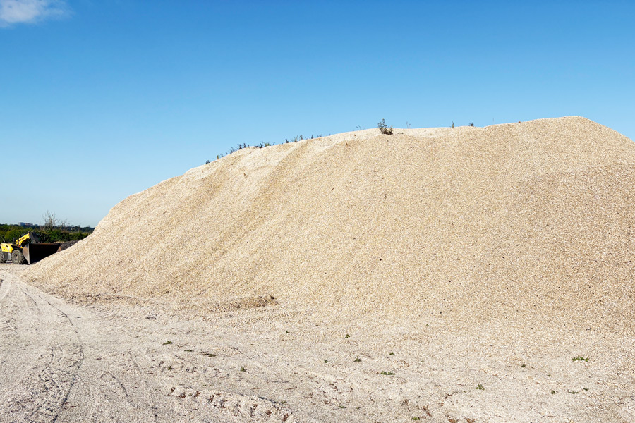
After about 3 miles, the track became more of a road and it seemed to be unusually bright. Looking closely at it I could see that it consisted of finely crushed tiny seashells, and a little further on I came across a huge mountain of them. After more pleasant riverside walking I came across an information board showing that I was at the final resting place of HMS Beagle, the ship that carried Darwin on the voyage of discovery, the findings of which were to prove his famous theory of evolution. Just after that I left the banks of the River Roach and made my way up Paglesham creek and onto Wallasea Island.
 |
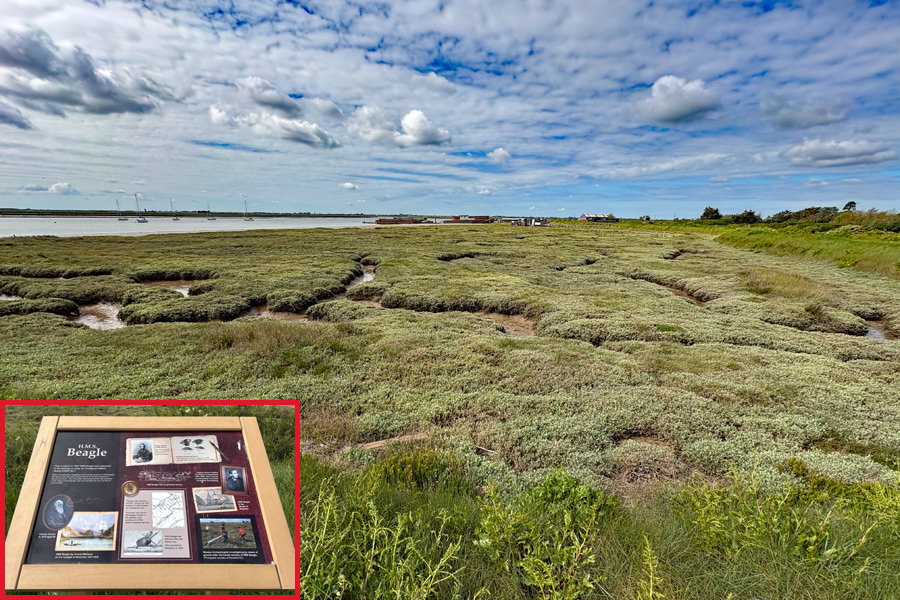 |
| A crushed shell mountain | HMS Beagle 'graveyard' |
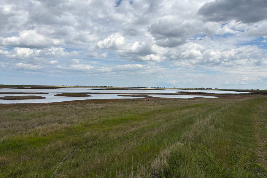
I decided to walk round the island in a clockwise direction so that I could first visit the cafe. I also spoke to the ferryman and confirmed the time of the last ferry. My proposed walk was to be 8 miles. I was nearly three-quarters of the way round when I found that my chosen route was closed due to nesting birds and when I attempted to try the alternative track along the top of the sea defences I found it to be impossible to locate it in the very long grass. I tried to push through but it was impossible to make any normal progress because I could not see where I was putting my feet on the rough ground. So I was forced to make a speedy retreat back the way I came. Any sort of short cut was not possible as it would have involved walking through other areas also reserved for nesting birds. I needed to get back before the ferry stopped at 6pm. I rang the ferry and left a message to say that I was still walking and would be back before then, which I was, at 5:35, but when I arrived the ferry pier was deserted. As my night's accommodation was in Burnham On Crouch, on the other side of the river, and because it was a 26 mile road trip to go round, I rang the ferryman, who had finished for the day, but thankfully, returned to take me across. He had not received my earlier message.
It had turned out to be a rather windy afternoon's walk during which I saw almost no one else but I did see a lot of birds. I didn't quite finish the circular tour of the island but later when I checked my actual mileage on my Ordnance Survey app I found that I had walked 13 miles around the 9 mile island! So I had walked 25 miles that day.
 |
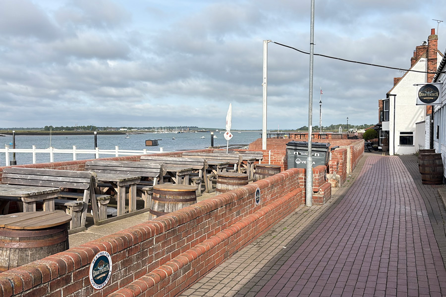 |
| The centre of Wallasea Island | Burnham On Crouch |
I had booked a single room with en-suite at the Royal Burnham Yacht Club for that night. I was a nice room with all that I needed. After a hot shower and a rest I went out for a meal and a drink. The ferry man had recommended The Anchor* as the place to go for good food.
*The Anchor was was not very busy, and as the two customers in front of me at the bar had both asked for a pint on Guinness I decided to have the same. I then asked for the menu and was told by the barmaid "Sorry love, no food tonight, there's a band playing," nodding towards the large empty space in the room that I had not noticed when I came in, where they were setting up drums and loudspeakers. I already had a pint being poured for me so I asked what snacks they had and she recited a list of flavoured crisps. I must have hesitated for a moment, so the guy sat on the bar stool next to me said, "go for the Longhorn Beef mate, they're the best." So I did.
I sat on my stool sipping my Guinness and munching my crisps. They did have a beef flavour, similar to most of the beef flavour crisps I have ever had, but when the first few notes were played by the nearby lead guitar I decide to retreat to the other bar. It was too much for me after five days of quiet countryside. The other bar was a small snug and it was completely empty.
As I left it stated to rain lightly. I didn't find a restaurant nearby and although I had noticed a fish and chip shop earlier but I didn't want fish and chips. I was getting damp so I went back to my room and dug out what food was left in my rucksack. I had bread rolls and cheese, then made a cup of coffee and had ginger biscuits and the remains of a bar of dark chocolate.
End of day 5: About 25 miles of the path walked today.
Next morning I bought some travel supplies at the mini-market and returned home by train. A few weeks later I returned to continue my Essex ramble.
Day 6: From Burnham On Crouch to Bradwell Marshes
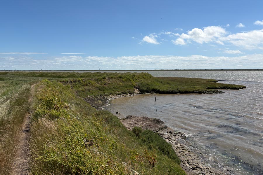
I arrived at Burnham On Crouch station at about 1pm and started my walk after a pint at the The Star Inn which is on the bank of the River Crouch. I walked out of the beer garden, turned left, and continued along the riverside walkway until I was out of town and walking along the top of the grass-covered flood defence bank of the River.
 |
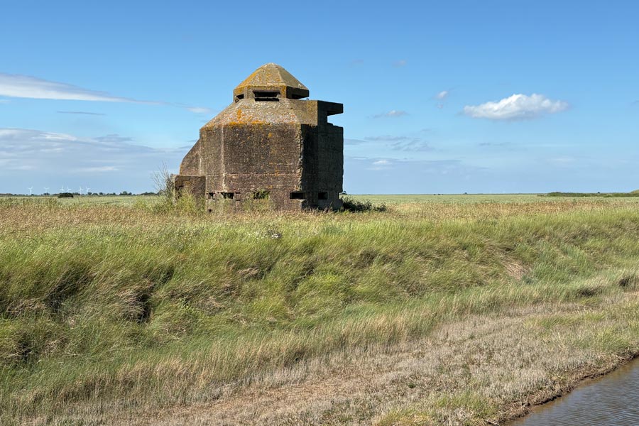 |
| River Crouch | WW2 Observation Tower |
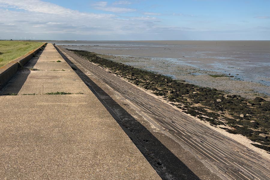
The walking was great. It was warm and sunny with a cooling wind. After walking eastwards for about 5 miles the path rounded Holiwell Point and began to head northwards. More water or mud flats to the right, more acres of low-lying fields to the left. There was very little change to this scenery except that for part of the way the rough path became a concrete path along the top of some concrete block sea defences. Part of the way along this section I came across a large collection of flotsam and jetsam, much of which was tied to both sides of a large metal gate on the path.
 |
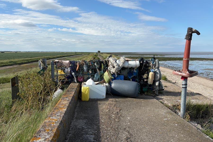 |
| Defences | Flotsam and jetsam |
I had booked some accommodation for this ramble but as there was none available in several places, (or I was too tight to pay for what was available), I took some camping gear with me. There had been no suitable accommodation available for that first day so after about 12 miles of walking I decided that it was time to bed down for the night. It was almost 9pm. This would also mean that the booked accommodation for my next night was about 16 miles away. Just right. I was treated to a lovely sunset and the sight of the Moon and Venus in conjunction, Venus being just above the tip of the Moon's crescent. Until I had stopped walking and settled down to rest I had not noticed the constant stream of aircraft passing overhead. I didn't realise that this part of the Essex Marshes was under a busy flight path. As the sky darkened, and although never completely dark at this time of the year, I was able see a few of the brighter constellations.
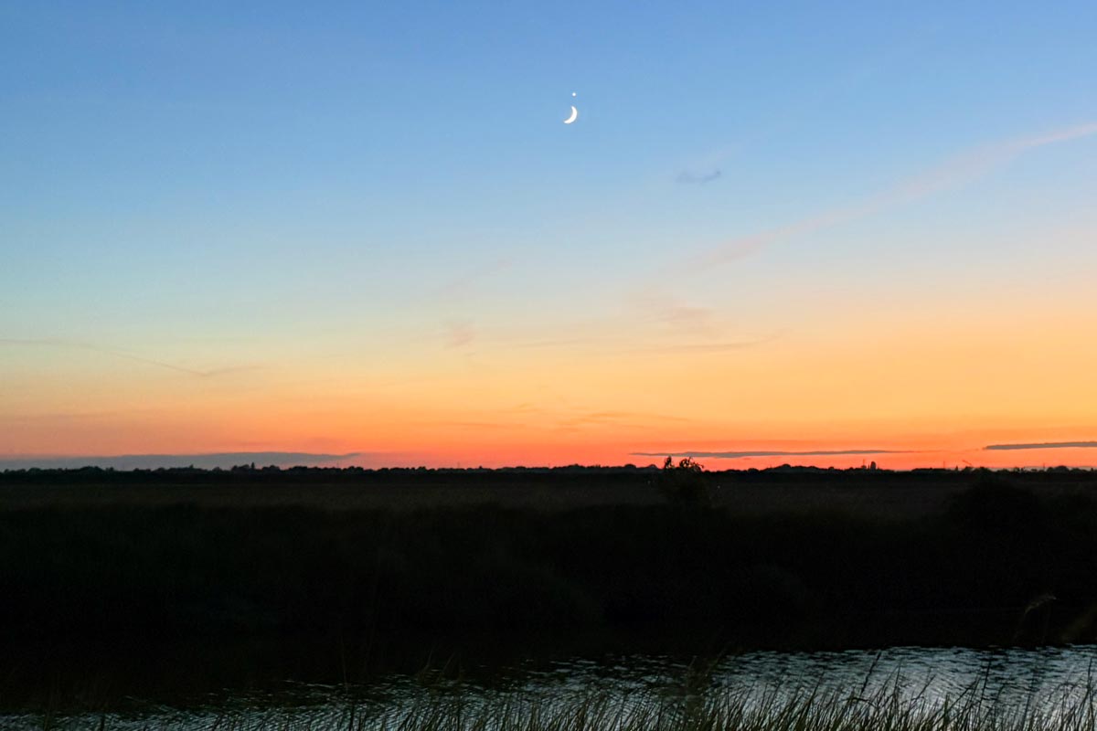
The crescent Moon and Venus.
End of day 6: About 12 miles of the path walked that afternoon and evening.
Day 7: From Bradwell Marshes to Maylandsea.
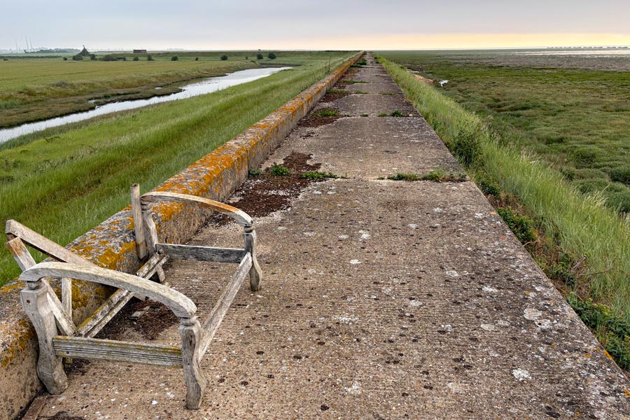
The sound of aircraft landing never bothered me and I slept very well but as the sky was dark-ish for less than six hours, I was up early and on my way by 5am. The long grass at the side of the path was wet with dew so I needed my gaiters. Later I came across another stretch of concrete walkway. Although I don't like to see a lot of concrete out in the countryside but it does make walking easier as there is then no need to keep looking down as is necessary when walking on uneven ground. This allowed me to enjoy looking at my surroundings more. Not that there was anything new to see, just marshes, mud and water, but they can be beautiful in their own way in the low morning sun. As well as walking the England Coast Path I was also walking along part of St. Peter's Way and I was looking forward to seeing the Chapel of St Peter, where I was intending to stop for my breakfast. The day began to warm up and by the time that I had arrived arrived I was hot and hungry.
 |
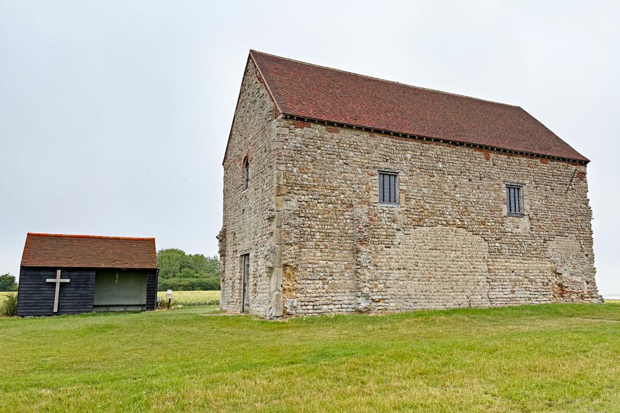 |
| Sea defences | St Peter's Church |
I sat on the bench in the little hut next to the chapel, to cool down and eat my breakfast. A cheese roll and some oat biscuits, washed down with most of the remainder of my water, which I hope to get refilled at Bradwell Waterside. In the chapel it was cool and quiet. I sat on a side bench for a while and thought about the feelings that I get when I am in a quiet holy place*.
* I am not a religious person but when I am when out walking alone and enter a holy place I always feel more peaceful. I believe that it is possible that there is a God, or something similar to a god and that understanding what that is may be beyond the understanding of the human mind. So I don't try too hard to I think about it. I also don't believe that a god would want us to waste our time and resources in worship and adoration. A god would surely want us to use our time and resources to help those less fortunate.
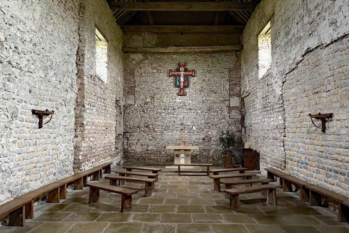
The Chapel of St Peter on the Wall c660
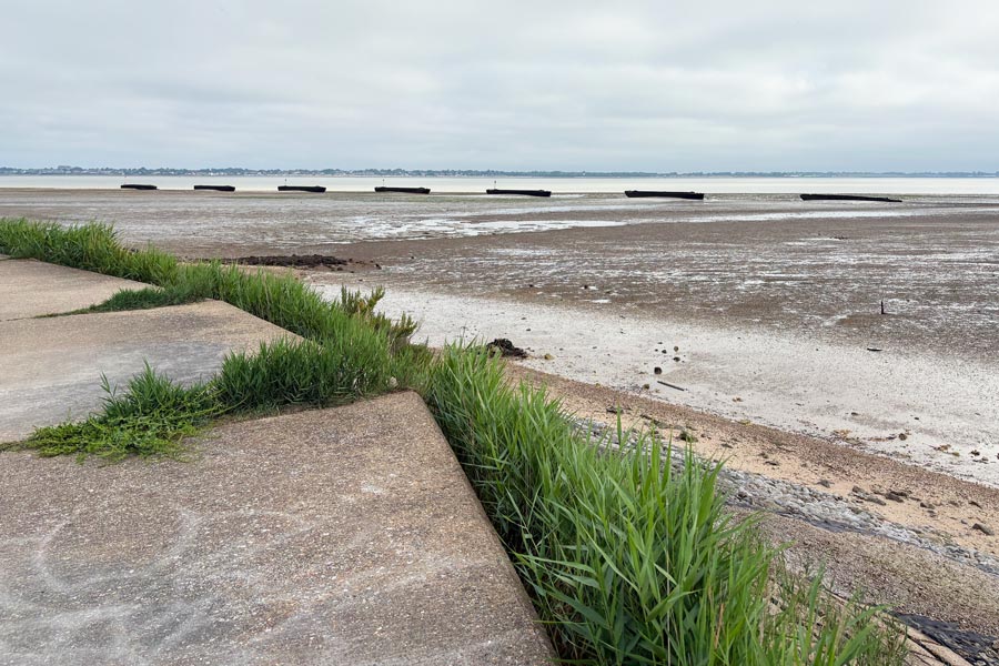
I walked on, with my thoughts about religion fading from my mind as the sights and sounds of my location took over. Rounding the northern tip of the land at Sales Point brought into view the opposite riverbank that I would be walking along in a few days. It was less than 2 miles away across the River Blackwater but about 40 miles away when walking there along the shore. There was a line of low black objects in the mud along the shore. These were concrete filled barges that were sunk to protect the wetlands, mudflats and salt marshes. Also the large white blocks of the twin reactors of the decommissioned Bradwell Nuclear Power Station, which had been coming into view for the previous 5 miles or so, were now beginning to dominate the landscape on this side of the river.
 |
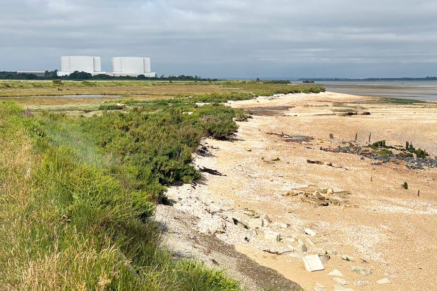 |
| View across the Virley Channel | Bradwell Nuclear Power Station |
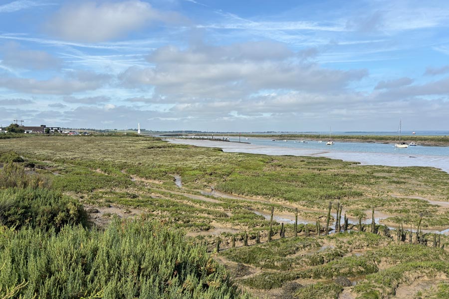
The path passed between the reactor buildings and the river and about 1 mile later I arrived at Bradwell Waterside and a marina. I needed water and a kind gentleman showed me where the outside water tap was at the static caravan park. I filled my bottle, drank it and filled it again. The weather was very pleasant, with a little cloud and a cool wind. By lunchtime I had arrived at the small village of St Lawrence, Ramsey Island. The Stone Inn there was not open, or had closed down. It appeared to be active according to tripadvisor but the last customer review was from 2022, and the CAMRA website showed it as being open*.
* Unfortunately the Internet is littered with websites providing out of date information. So I take great care when searching for more important information such as bus timetables. I go directly to the actual bus service provider's website not something that sounds catchy.
I continued on towards Maylandsea where I had booked accommodation. The walking was much the same, low lying fields on the left of the path, mud and/or water on the right. It was still windy but getting hotter. As I approached Maylandsea rain clouds ahead were closing in and I was hoping not to need my waterproofs before I got there. That was not the case and I arrived hot and sweaty due to having to wear them.
 |
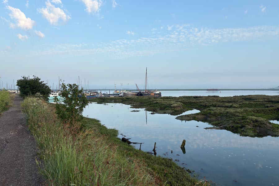 |
| Approaching Bradwell Marina | Maylandsea |
I stayed at a small motel situated behind Hardy's Bar and Grill at Maylandsea. The room and it's facilities were good and I had soon showered, washed my sweaty top, pants and socks, hung them to dry and went to get a meal. Unfortunately there was no chef that night at Hardy's but the friendly bar staff were making cheese and ham toasties for themselves so they made one for me. Hardy's wasn't busy but because it had a hard floor and other hard surfaces the sound of the small group of men talking loudly and swearing was very noticeable and annoying, so after my pint I wandered down the road to the mini-market to get some supplies and then had an early night.
End of day 7: About 17 miles of the path walked.
Day 8: From Maylandsea to Maldon.
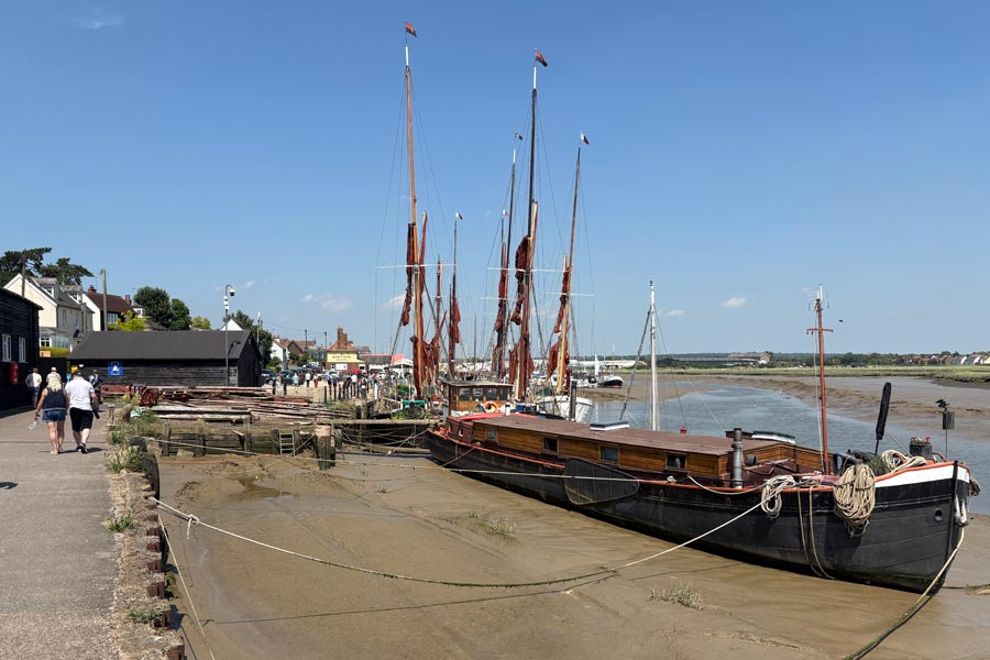
I was up early and walking before 6am. It was another clear sunny day but already it was getting hot due to the lack of wind. The path was similar to the day before but the river was high. As the heat increased I began to slow down. The going wasn't difficult but I was getting hot and tired. I reached Maldon at about 11am and walked out of the sun, into a shady tree lined park and then past the water park which was full of children playing in the fountains and pools. I sat on a bench in the shade of a tree and overlooking the riverbank where I ate my remaining supplies and drank the last of my water. I had intended to walk well beyond Maldon that day and camp out that night as suitable accommodation was non existent along next part of the route ahead but I decided to stop at Maldon and take it easy for the rest of the day. I then walked along the picturesque boat-lined waterfront and into the town, stopping at The Rose and Crown for a pint. On-line I booked a room at the Maldon Travel lodge where later I dropped off my rucksack and had a refreshing shower. In the mid afternoon I wandered leisurely around the town and bought a few things*.
* I had lost the neck buff that I use to keep the sun off the back of my neck so I bought a new one. My feet seemed to have been affected the heat and my big toes were hurting as if they were touching the fronts of my boots so I bought some thinner walking socks. There was no outdoor shop in the town but I found an outdoor section in the sports shop. I had also forgotten the lanyard that I always attach to my iPhone case when on walking trips. As I am often photographing from viewpoints overlooking the sea or on bridges overlooking rivers, etc., I like to secure my phone to my wrist as soon as it comes out of my pocket so that I have no chance of dropping and loosing it. I bought a pair of thin shoelaces and used one of them to make a lanyard. Better safe than sorry.
That evening I wandered down to the nearby Muddy Duck where there was a beer garden and a pizza kitchen at the back. I love beer and pizza. It was a hot evening but I had grabbed a table with an umbrella where I then enjoyed good beer and good food and good reggae and even enjoyed being probably the oldest person there! Life is much easier to enjoy when you don't feel the need to posture.
 |
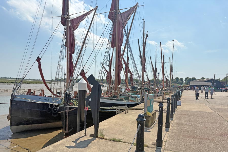 |
| Maldon | Maldon |
End of day 8: Only about 9 miles of the path walked.
Day 9: From Maldon to Tollesbury Wick Marshes.
 |
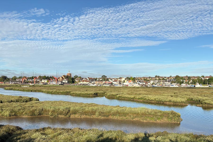 |
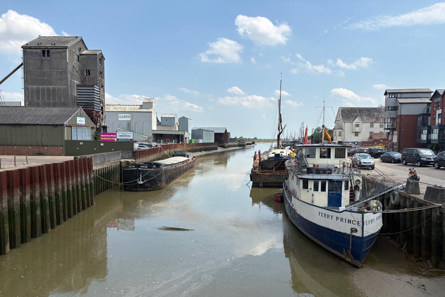
| Crossing the bridge, Maldon. | Looking back at Maldon. |
While walking east along the River Blackwater early the next morning I had some great views of Maldon when looking back over the river. It was already getting warm. I slapped on some factor 50. I had been unable to find any accommodation for the next part of my walk and was hoping to find some at Tollesbury. If not, I would camp out. The walk was pleasant and I knew that the scenery would mostly be the same on that day has I had been for the last several days. So far I had encountered very few walkers, other than dog walkers, and saw no one with a rucksack large enough* to have been doing was I was doing.
* For this walk I was using my 55 litre rucksack. I had cut down on my clothes and carried no spares apart from extra socks and an extra polycotton top. If I was using accommodation I would wash the socks and the top that I had worn that day and let them dry overnight. I would wear the clean top that evening when going out to eat and a drink. I would have likes to have kept my pack down to about 7 kilos as I find it a comfortable weight to carry all day, but I ended up carrying about 10 kilos. The extra weight included my sleeping bag, bivvy bag and inflatable mattress. I know that you are probably saying "blimey, that's not much, I carry more than that!" But I am getting near 80 now and don't find it easy to carry an extra stone and a half all day any more."
 |
 |
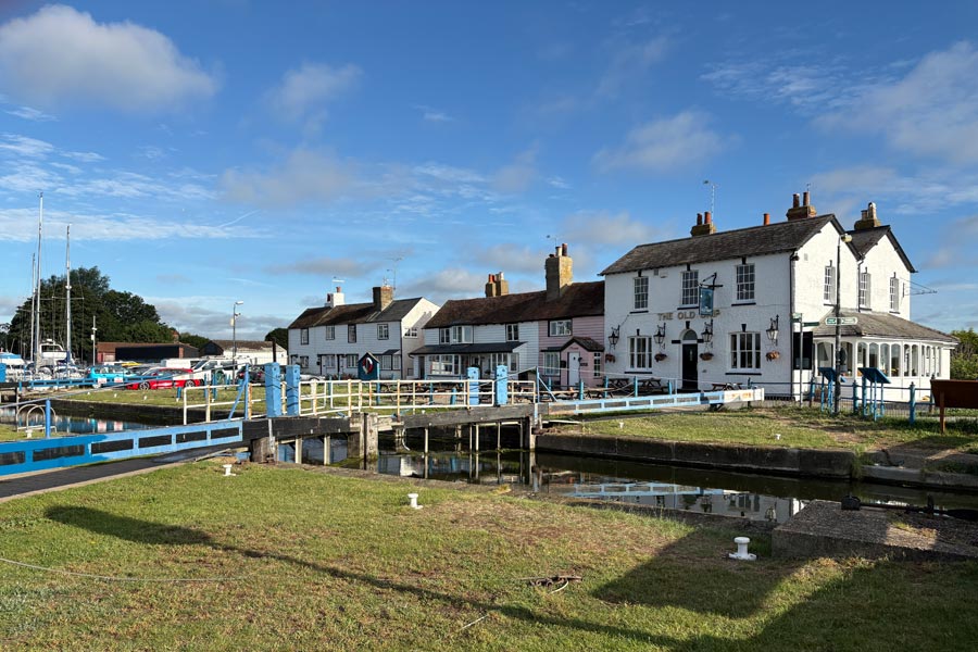
| Heybridge Basin | Heybridge Basin |
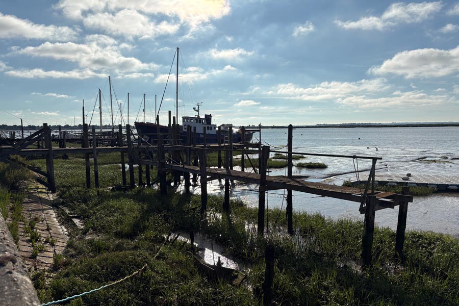
I stopped at the picturesque village of Heybridge Basin to take photos and then a little further along the path spent some time reading the comments written on the side of one of the less picturesque wooden huts built on piles over the water/mud. It seemed to be being renovated and I guess it was taking a long time because there were over 90 questions, answers and comments about it written on it's unfinished wall.
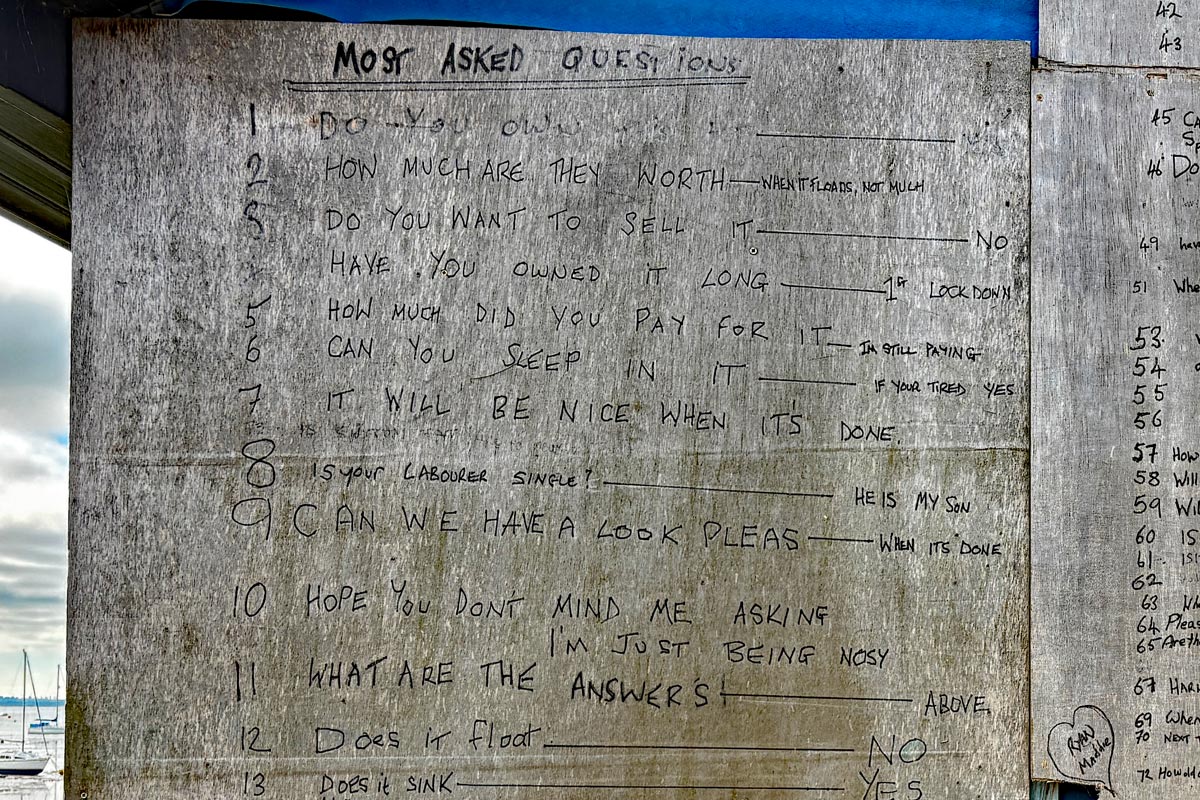
The first few questions.
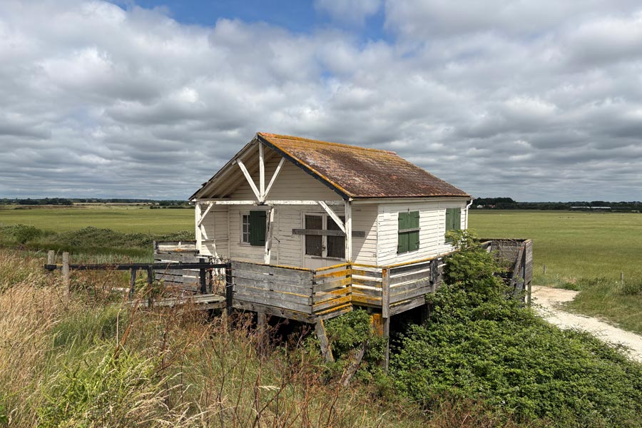
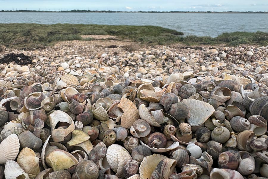
After Decoy point there was no habitation on the path until Tollesbury. There was one derelict wooden shack on stilts and a lot of long grass to wade through. I also noticed that there were a lot of shells along the riverbank. There was some cloud and a little wind but it was hot and I had soon run out of water. I left the path and headed along a track that was a shortcut to Tollesbury. There was no wind on the track but there were a few shady trees. I was still very hot by the time I got to the town square. At The Kings Head, I had a pint, (cash only), got my water bottle filled up and enquired about accommodation but there was none in the village. So as I was sleeping out that night, I went to the nearby shop and bought some supplies for my supper. I returned to the coast and continued on the path until the evening where I camped, somewhere on Tollesbury Wick Marshes.
 |
 |
End of day 9: About 16 miles of the path walked. Detour to Tollesbury not counted.
Day 10: From Tollesbury Wick Marshes to Salcott.
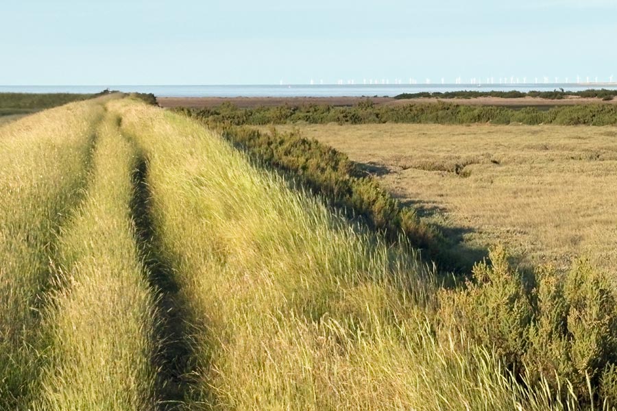
I awoke early. There had been a heavy dew and the long grass and bivvy bag was covered in beads of water. I used part of my trail towel to soak them up until it was wet enough to give myself a refreshing all-over wash. I placed my damp bivvy bag and trail towel on a fence and stood in the sun to dry off. I took my time as I only had about 12 miles to go that day. After a light breakfast and when everything had dried and was packed away I strolled on. The grass on the path was long and was slightly more difficult to wade through but the sun and the breeze had dried off the dew. The path followed the edge of Woodrolf Creek, to the outskirts of Tollesbury where I nipped into the village again from a different direction to buy supplies for the day, and returned to the path, continuing around Tollesbury Fleet and then following the perimeter of the promontory at Old Hall Marshes. The path here was very overgrown in places making it difficult to walk along. It became quite breezy but I was still very hot. I slowed down to try to keep cool.
 |
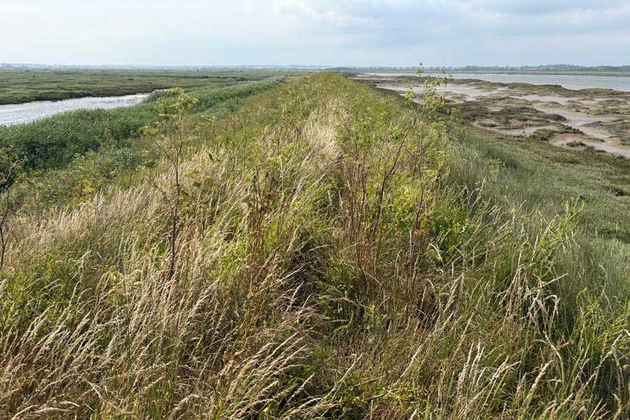 |
| long grass | Overgrown path |
I arrived at Salcott in the afternoon. I filled my almost empty water bottle from a tap in the churchyard and sat at a picnic table in the village sports field nearby to eat a late lunch in the shade of a tree. I must have sat there for at least an hour. There were only houses and a church in the village, but I think that there must have been a slaughterhouse nearby for I kept hearing the unmistakable squeals of large pigs followed by a sudden silence. Later I walked out of the village to the Colchester Road crossroads to check where the bus stop was. Then I retraced my steps back through the village to the marshes where I had noticed a discrete and remote spot to spend the night.
End of day 10: About 12 miles of the path walked.
Salcott was the end of that section of the England Coast Path according to the National Trail website. The next section was a path around the perimeter of Mersea Island, and that was where I was going the next day by bus. There were no public footpaths that would get me there.
Day 11: Mersea Island
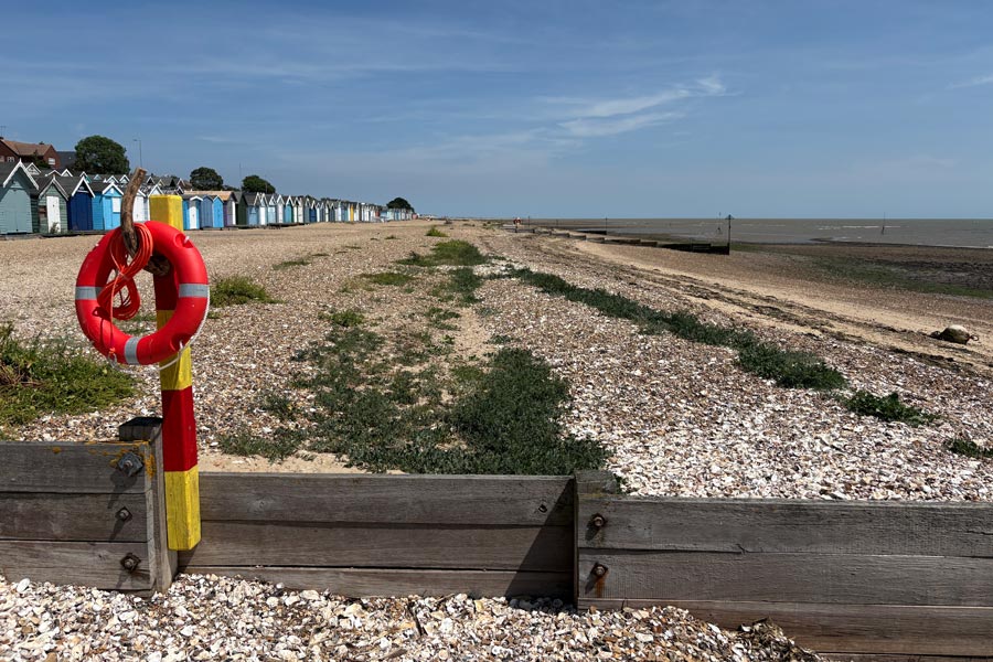
From Salcott I took the 07:52 number 52 bus to Colchester. I arrived at about 08:30 and went straight to The Playhouse for a Wetherspoon breakfast. I then went to the nearby number 67 bus stop in good time for the bus to West Mersea on Mersea Island, but when the bus came the driver made no attempt to pull into the line of bus stops, he just drove past on the other side of the road. So I had to wait an hour and 10 minutes for the next one. Rather annoyed, I wandered off to kill time and to buy some supplies. I had booked accommodation at The Nook near the most westerly point of Mersea island but unfortunately I got off the bus far too early and then had a 40 minute walk to get there. Consequently I did not arrive until about 12 noon. I had arranged to drop off the heavy stuff in my rucksack at my accommodation before my booking-in time to make the walking easier, which I did, so I started walking the path straight away, beginning at the lifeboat station. It was then about 12:30 and I wasn't too happy about such a late start. I had water but had left my food supplies at the accommodation, so after about 10 minutes of walking I came to The Victory where I went in for a pint and a snack.
I followed the coast road eastwards then turned down to Monkey Beach where I walked along the beach on the damp sand below the pebbles. It felt good walking without my usual heavy load. It was very hot and there was a strong head wind blowing which helped to keep me cool. After about 2 miles I was out of the town and walking the rough paths behind the beach. My Ordnance Survey Maps app did not show the ECP route and it was not on the OS maps that I had printed, but it was signposted. After another mile and a half the path was routed inland around a youth camp and an unused boating lake and then across farmland to East Mersea before returning to the coast. After almost 7 miles I arrived at the eastern end of the island. I had taken about three and a half hours to get there so almost immediately I started to walk back around the top half of the island.
 |
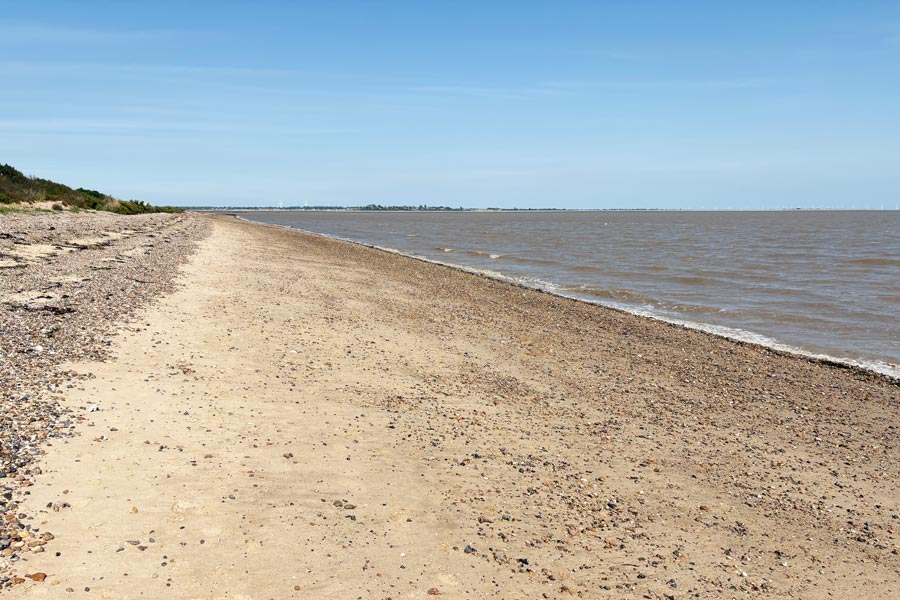 |
| West Mersea Beach | Mersea Flats |
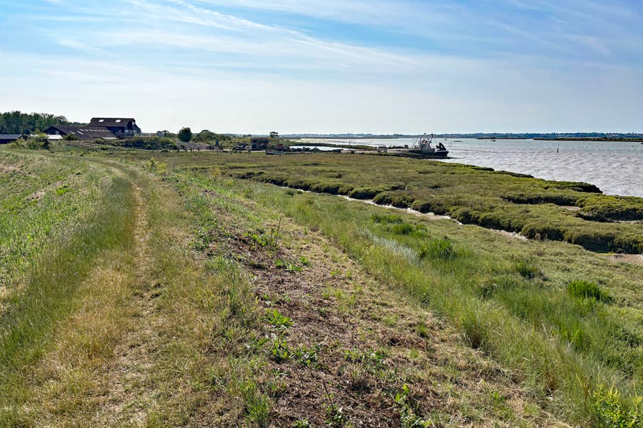
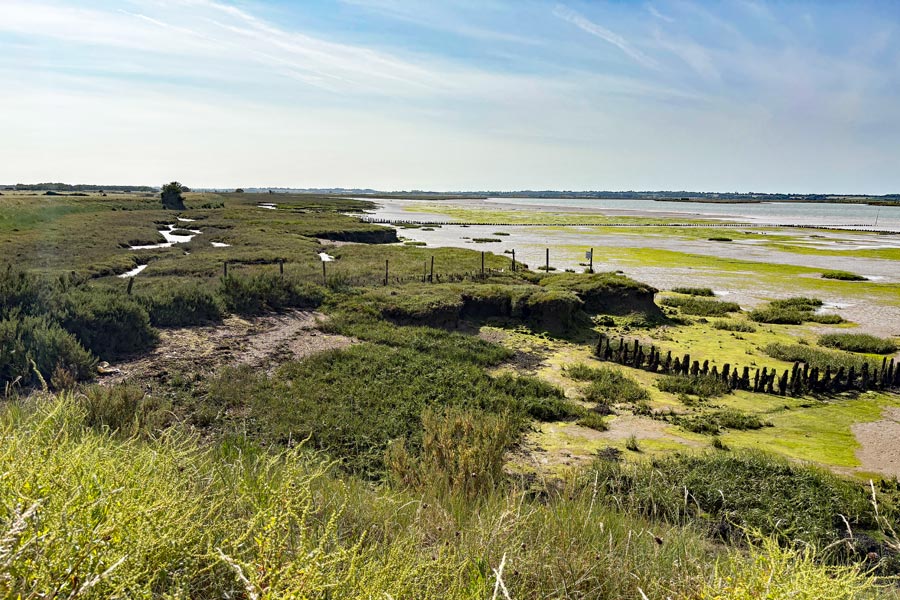
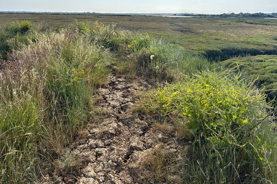
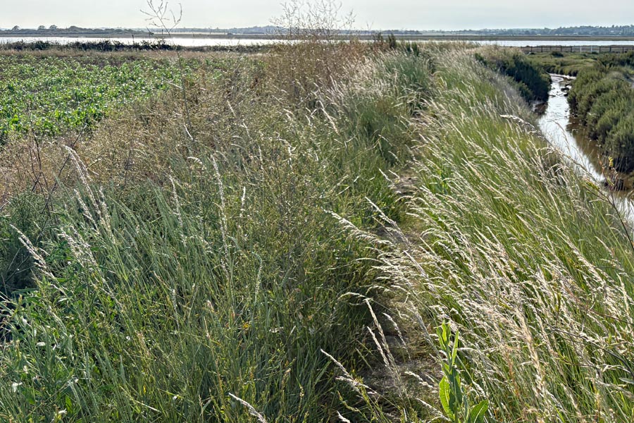
At first the going was easy on the top of the river defences but the grass got longer and required more effort to wade through and wind was now behind me so it didn't have the same cooling effect. My left toe stated to hurt but I ignored it and forged on. I was now walking faster that usual as I wanted to get back, get showered, and find place to eat before it got too late. After about 3 miles the going started to got even more overgrown and difficult and a mile later the path was so lumpy and cracked open it forced me to slow down. In places the grass was so long that it was difficult to see where I was placing my feet and there were places where lumps of earth been pushed up or had slumped. There were also some rather large holes.
 |
 |
 |
 |
On reaching the roadway near The Strood, the causeway that is the access to the island, I was a little baffled by the placing of the ECP signpost. After crossing two roads the going got easy again and I was walking along the wide path on the bank of the Strood Channel to get back the the Lifeboat Station, which was where I started from. It was then about 7:20pm. When I got back to my accommodation I took my boots and socks off and found that the nail my left big toe was completely black. It also felt a little loose! I looked at my other foot and the nail on that big toe was also black, but not loose. I decided not to go out to find somewhere to eat. I showered and made a meal from my supplies. I had an early night because I wanted to catch the first bus to Colchester in the morning.
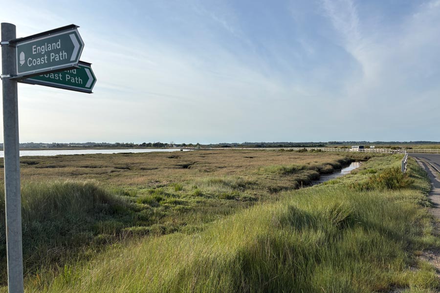 |
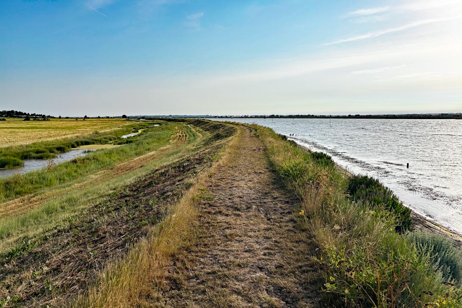 |
| Baffling signpost | Easier path again |
End of day 11: About 14 miles of the path walked. Extra 2 miles bus stop mistake not included.
Day 12: Shotley Point to Levington.
From Salcott I traveled to Colchester by number 55 bus then traveled by train to Ipswich. Here I took the ferry to Shotley Point. That was the start of the next available section of the England Coast Path. When the section between Salcott becomes available I hope to return and insert it into this account.
It was a short walk from the Harwich Town railway station, to the ferry On the ferry to Shotley Point. Before the first ferry crossing at 09:50 I had a bacon roll and a coffee from a stall while I waited. On the ferry I met James from New Milton in Dorset, who was also walking the ECP. We chatted during the short ride and found that we were both at about the same point on our anti-clockwise walk around the English coast. He was the first person that I had met so far who was also walking the ECP. It was already very hot as I started to walk away from the ferry landing point. James was a lone walker like myself so I let him get out of sight before I started out.
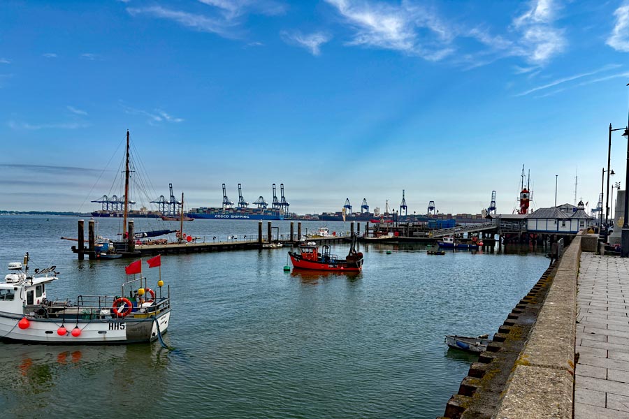 |
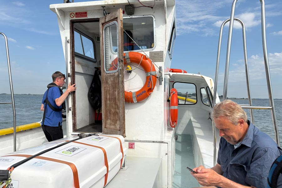 |
| Harwich | Ferry to Shotley Point |
It was even hotter that day and there was very little wind. I stopped regularly to drink water and was planning to refill it at the pub on the riverside at Chelmondiston, about 5 miles into the walk. After about 4 miles of walking I came across the Cliff Plantation, which was nearly half a mile of cool shady walking through the trees. I sat on a large log and lingered there a while. Shortly after emerging from the trees I arrived at The Bull and Oyster where I managed to bag the last table with an umbrella to drink my pint under. I also got my water bottle refilled.
 |
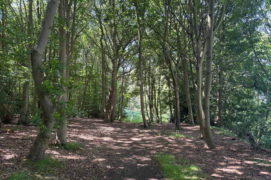 |
| The River Orwell | The Cliff Plantation |
My hoped-for destination for that day would have been Felixstowe where I would have booked accommodation but it was over 22 miles away, which I might have managed if it had been a cooler day and if I had started walking much earlier than 10am so I decided to camp out when I had run out of time or energy and then walk the rest of the way to Felixtowe the next day and catch a late morning or early afternoon train home. I would have liked to walk for a few more days but the heatwave was going to continue and the forecast was for it to be even hotter. Also I thought that I should probably give my big toes a rest. Both toenails had now turned black and were slightly loose.
About 4 miles after my pub stop was the Orwell Bridge across the River Orwell. As I had almost run out of food I was wondering if I would have to walk past the bridge first to find a shop. But as I approached the bridge I spotted The Suffolk Food Hall which also had a play area and covered outside seating. There I found a water dispenser and refilled my bottle. I entered and took a shopping basket and searched for suitable supplies*.
* I was wanting bread rolls, cheese, fruit, extra water and anything else that took my fancy. As it was much more that a supermarket the rolls were sold separately from labeled baskets containing rolls of every description. I picked two of the healthiest sounding ones and placed them in a bag. I looked for cheese. I just wanted a small block of cheddar but the cheese counter was huge and everything had to be cut to order. There were also far too many cheeses to choose from, so I asked the lady behind the counter for "enough cheddar to fill these please" and I showed her my two large bread rolls. Whereupon she sliced off a few samples and presented them for me to choose. Which I did. The nicest one was from Dorset. As she handed me the little bag of cheese she said "slices of tomato would be nice too wouldn't they?", to which I agreed and went of to fined some. The smallest amount I could find was a stick of little tomatoes on-the-vine, so I took one of those. If I had found a crusty pasty or some similar savory item I would have added that but there was nothing that was robust enough to stand being stuffed into a rucksack. I searched for water, but although there were plenty of choices of flavoured water, they were all tiny, all in glass bottles and all were expensive. I asked an assistant if they had large bottles of plain water and she lead me to where they were, but they were only slightly larger and were all glass bottles. I knew that I was not going to find a two litre bottle of water for 99p here, as I had done in a supermarket recently, but I had hoped for plastic bottles because didn't want to be lugging glass around, so I didn't buy any. I then bought some apples and spotted some tropical-trail-mix on the way to the check-out. Outside I sat in the shade, drank more water, munched some trail-mix and then filled my bottle again before moving on.
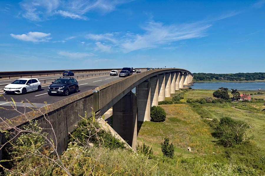
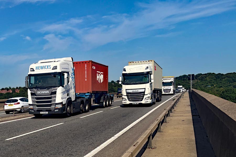
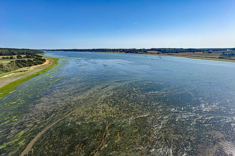
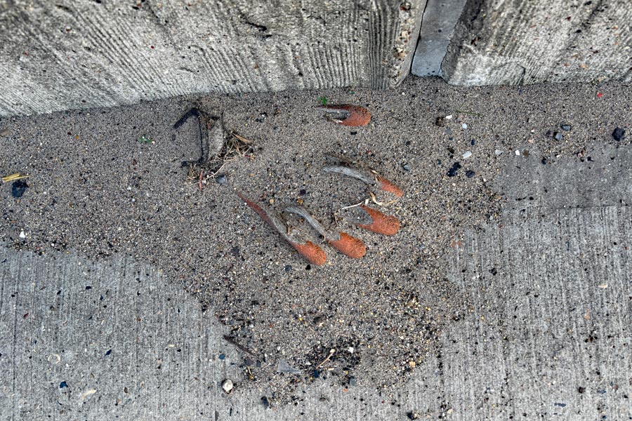
Shortly afterwards, after the steepest climb that I had made in a long time on my coastal walk, I was on the Orwell Bridge. The wind was strong up there, and combined with the wash from the two lanes of head-on traffic thundering towards me, especially the trucks, I was blasted with dust. I walked past many smashed bits of cars and other debris on the walkway and noticed how little piles of grit had built up around some of them. I put my earplugs in to reduce the tremendous noise. The view were superb but it was difficult to stand still enough to take a photo due to the constant buffeting from wind and traffic wash.
 |
 |
 |
 |
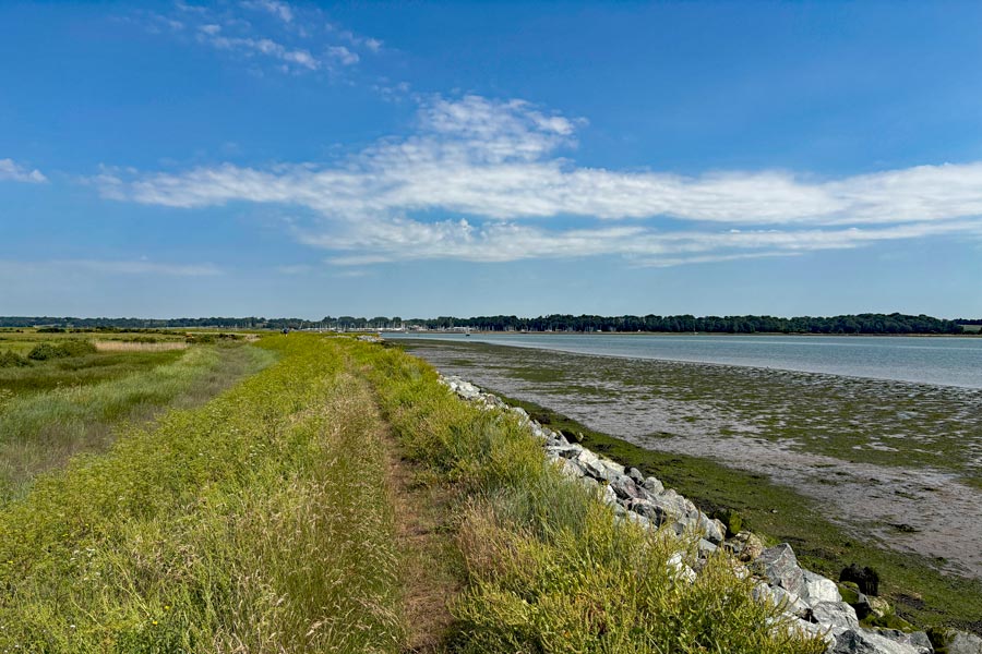
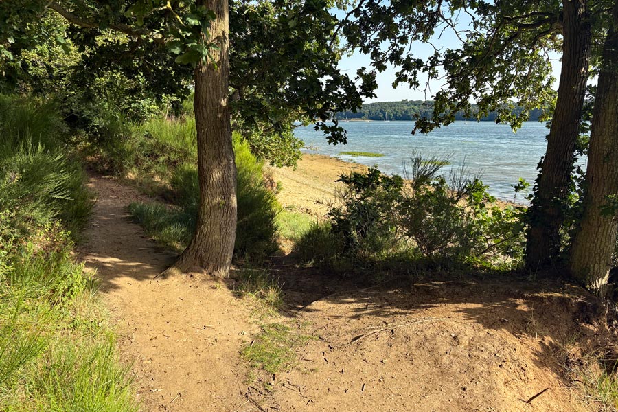
As I left the bridge and descended the steps down to ground level the traffic noise died away to a light roar. I was now in Suffolk so I was at the end of my Essex ramble. Soon I was walking through the shade of the trees in the Orwell Country Park. It was about 6pm as I left the park. There was a little wind but the sun was still very warm. They path continued along the foreshore and in places that would have been flooded during high tides I walked along and over stretches of bleached seaweed, dried and crusty.
 |
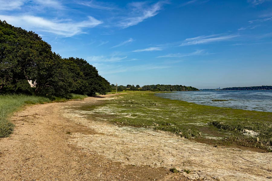 |
| The Orwell Country Park | The floodable path |
About 4 miles after the bridge I received a message from my wife telling me about the many trains in the south east that had been canceled that day due to the heat wave that had been causing the railway tracks to become distorted, and that there were likely to be more cancellations the next day as it was going to be even hotter. She had been tracking my movements on her iPhone. She suggested that I should end my walk and divert inland to where I could catch a bus to Felixstowe and get a room for the night, then catch the earliest train out of Felixtowe in the morning.
I agreed with her plan and instead of walking on to Felixtowe, about 8 miles away, I turned off the trail and walked to Levington where I stopped at The Ship for a pint, booked a room for the night, booked a return journey by train for the next morning, then walked about a mile to the bus stop on the main road where I caught a bus to Felixstowe.
End of day 12: About 15 miles of the path walked before heading off the trail to Levington.
That concludes my ramble around the coast of Essex. Hopefully more to come later when the missing parts of the Essex section of the England Coast Path have been opened.
This walk was 188 miles of Essex coast and 5 miles of Suffolk in 12 days.
If I bring forward my previous total of 926 miles this makes a grand total of 1,343 miles of England coastal paths walked on my coastal ramble.
My journey train home started at 6:36am. I had a five train journey to get home. The first two trains were comfortably cool. The third was on the underground Jubilee Line, hot and crowded. On the forth train the heat was stifling and they were apologising for the lack of air conditioning and handing out bottles of water, and the fifth train was the same except that there was no complementary water. Although it was an even hotter day than the day before none of the trains that I had booked were canceled, or even delayed, and so I was home by about 1pm.
back to the start of the Essex ramble from Tilbury
back to the start of the Essex ramble from Burnham on Crouch
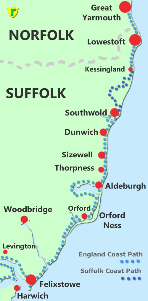
Levington, Felixstowe, Orford, Aldeburgh, Thorpness, Sizewell, Dunwich, Southwold, Lowestoft, Great Yarmouth.
This walk is being updated.
Day 1: From Levington to Felixstowe.
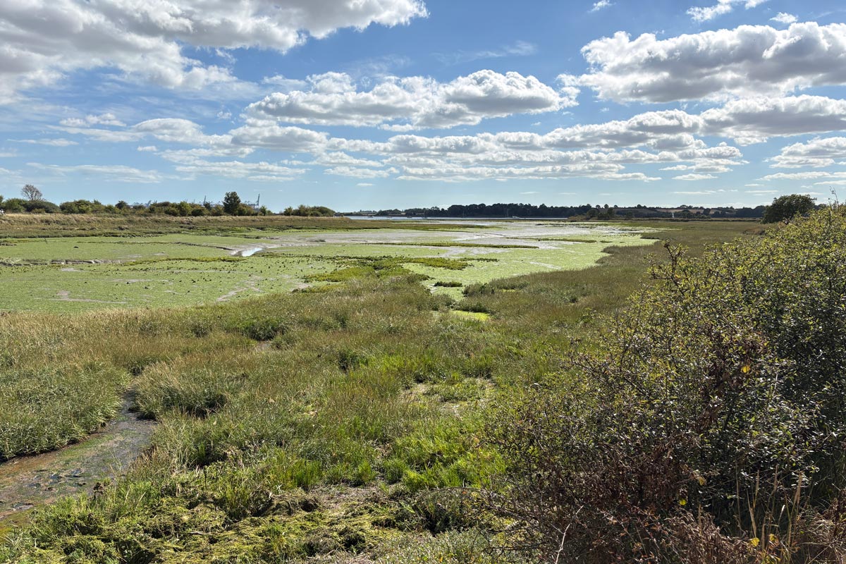
I traveled by train to Ipswich then used a number 75 bus to get within a mile or so of Levington, where I had terminated my previous walk. I arrived at the Ship Inn in Levington at about 1:30pm, had a quick pint and a snack then continued on down to the the River Orwell at Levington Creek. It felt good to be walking the river bank again. It was warm and sunny and peacefully quiet.
During the next 4 miles of good countryside walking I was very aware of the huge cranes of the Port of Felixstowe growing larger and larger on the horizon until after about 4 miles they completely dominated the view ahead. I stopped for a rest and watched the continuous stream of container carrying trucks that were feeding the huge cranes that were loading a monster ship.
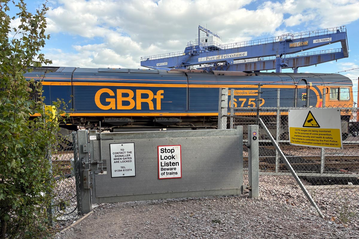
The path then passed around the edge of the landward side of the docks and at the southern end I came to a two-track level crossing where a huge diesel locomotive pulling an unknown number of container carrying trucks was just about to cross on its way out of the docks. The huge steel slab of a gate was locked. As the locomotive roared into life and slowly dragged its load across in front of me, the screech of the steel wheels on the tightly curving track was deafening. I waited and waited but the trucks kept coming. Eventually the train passed through and the gate became unlocked allowing me to cross the railway lines. The gate was very heavy and so was the one on the other side. Then almost immediately there was a similar crossing with similar gates with five more tracks to cross. There was no train in sight so the gates of this crossing were unlocked.
The route then passed through an industrial area and down to the sea front. From that point there was an excursion of the path to the right towards Landguard Fort but I turned left and walked into town to book into my accommodation as it was past 5:30pm by then. I returned later that evening to walk out to the fort and later had fish & chips overlooking the sea.
 |
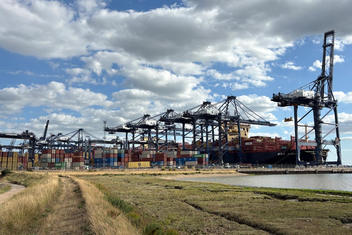 |
| Levington Creek | Felixstowe Docks |
 |
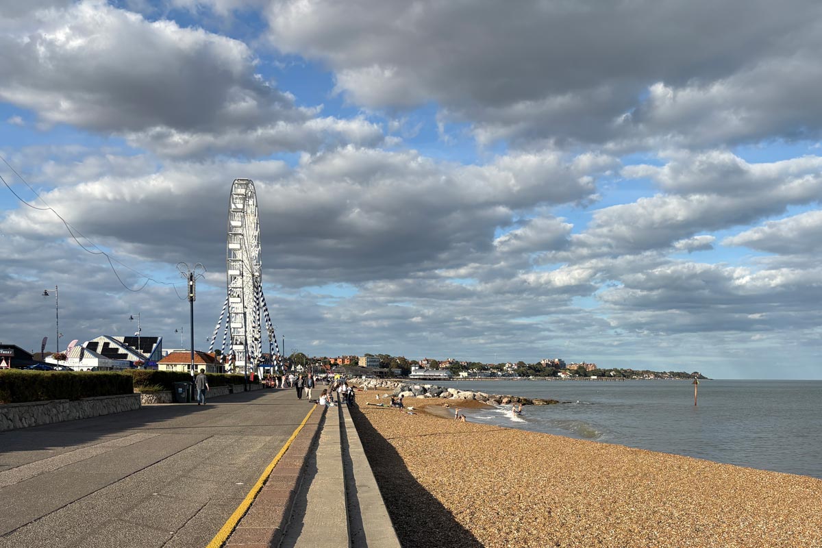 |
| Level crossing | Felixtowe |
End of day 1: About 9 miles of the path walked today after returning to the trail near Levington.
Day 2: From Felixstowe to Orford.
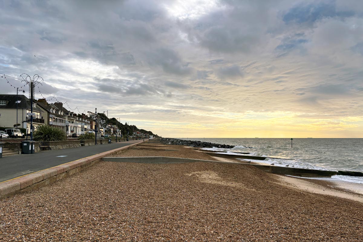
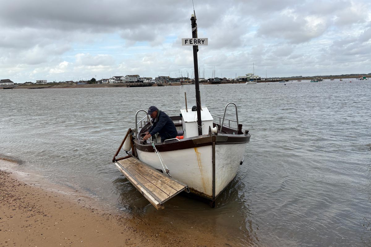
Day 2. As I strolled out of Felixstowe the horizon ahed was bright but there were plenty of clouds and a few spots of rain but not enough to need waterproofs. The path was on top of the sea defences and passed a golf course and two Martello Towers. By about 9am I had walked the 3 miles from Felixtowe and arrived at the Bawdsey Ferry. I had decided not to walk inland along the River Debden to Woodbridge and back to the coast again but to take the other option of a ferry crossing instead. I had been to Woodbridge on a previous trip.
 |
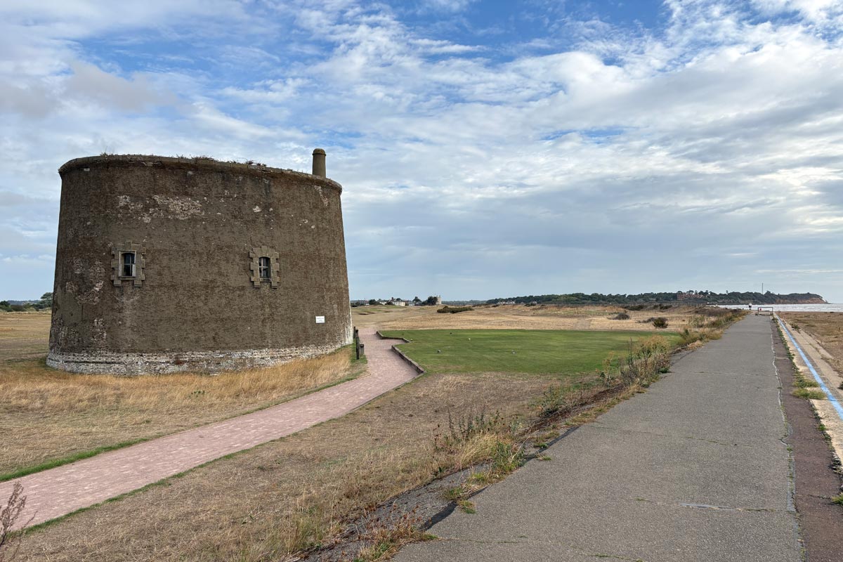 |
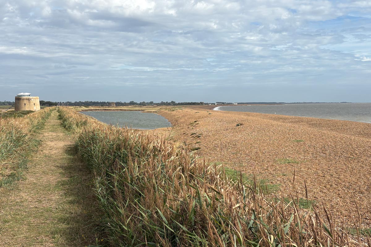
I took the ferry across at about 9:15am. After about a mile of road walking, the England Coast Path split from the Sussex Coast Path and returned to the coast again, thereby missing out Bawdsey. There had been plenty of nice new ECP signs to follow since Felixtowe. My Ordnance Survey app didn't show the ECP route yet but I had checked it on the nationaltrail.co.uk website and found that it mostly followed the route of the Suffolk Coast Path as far as the Butley River. The walking was great, with periods of sun and cloud. There was a light wind blowing to keep me cool. I walked past a large gun emplacement and four more Martello Towers.
 |
 |
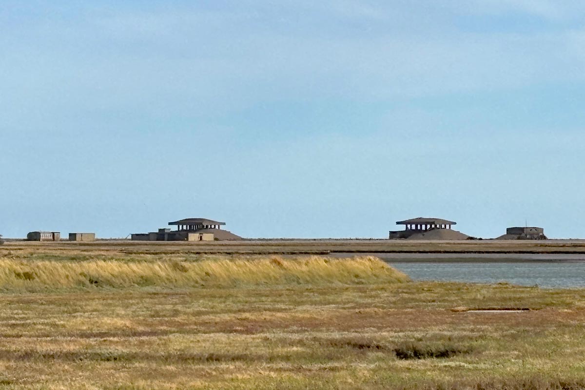
After about 6 miles the Entrance to the River Ore appeared and beyond it began the tip of the long thin strip of land, almost totally cut off from the mainland by the River Ore, called Orford Ness, where secret experiments in radio, navigation, radar, and nuclear weapons were held during both world wars and up to the early 1980s. It is now a National Nature Reserve managed by the National Trust. In the distance I could see a line of strangely shaped buildings there.
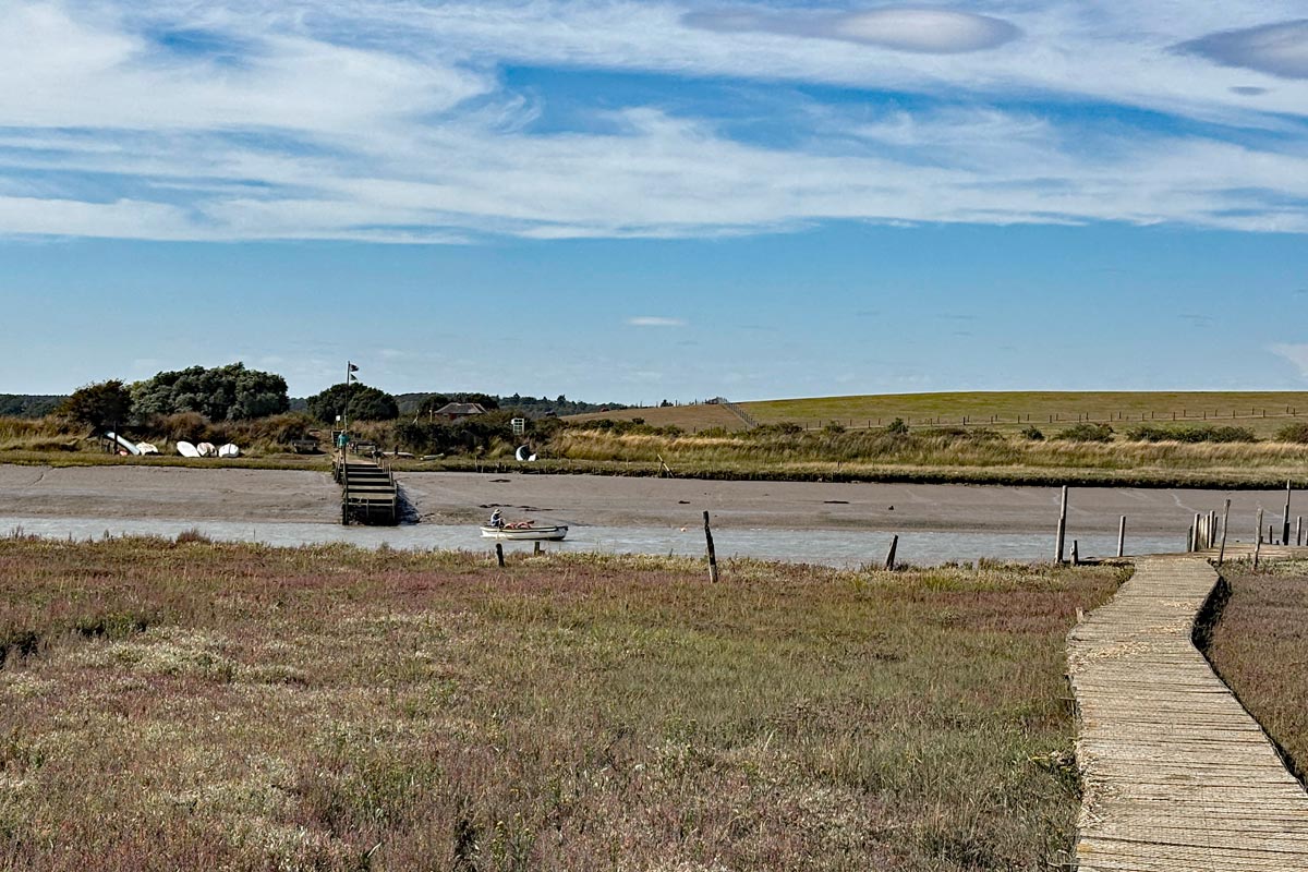
A short way along the River Ore was a tributary called the Butley River along which I walked as far as the Butley Foot Ferry, a volunteer operated ferry that runs on weekends and Bank Holidays between Easter and the autumn. This allowed me to keep walking along the coast and avoid a long inland walk that would have complicated my accommodation arrangements. From the other side of the river I walked back to the Ore and continued on a pleasant walk to Orford, during which I took pictures of a few of the strange buildings on Orford Ness.
 |
 |
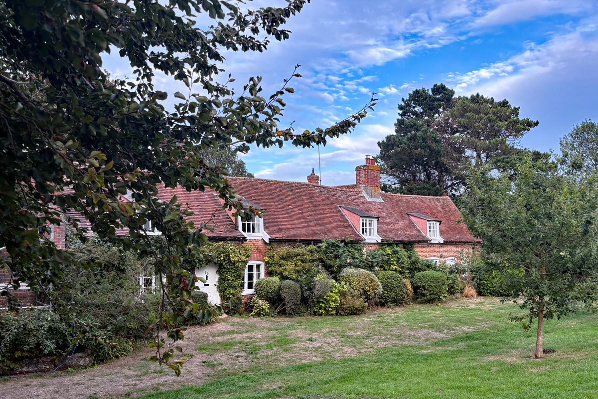
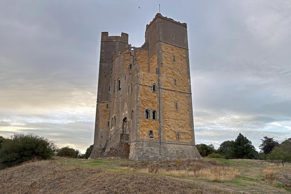
I stayed at The Jolly Sailor on Orford, just a short walk from the river. Later I had a stroll around the pretty little village and visited The Kings Head Inn and at dusk, photographed Orford Castle.
 |
 |
End of day 2: About 17 miles of the path walked.
Day 3: From Orford to Aldeburgh
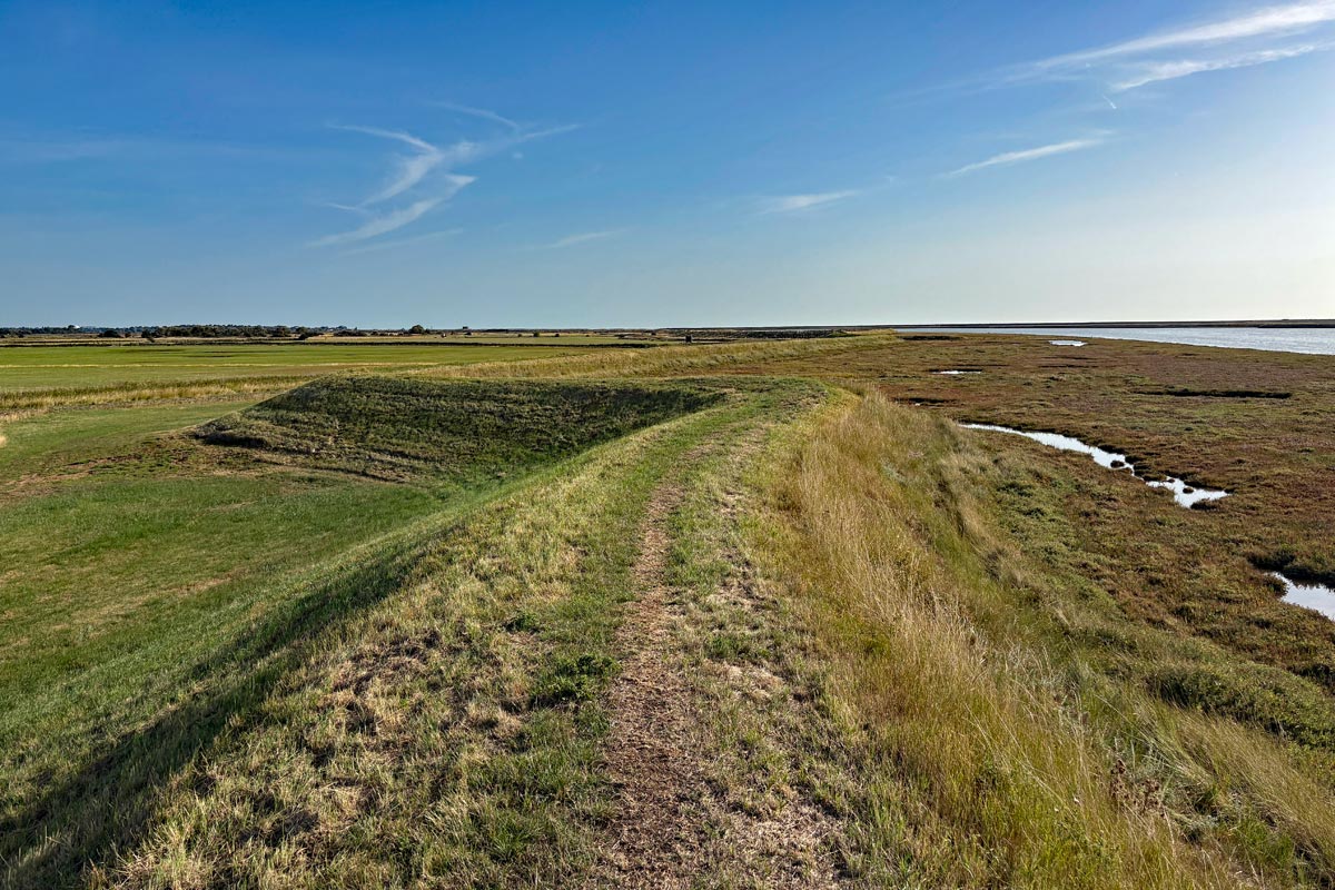
I had an early start and was walking by 7:30 along the banks of the River Alde which was still running paralell to the coast with Orford Ness between it and the sea. As well as more odd shaped military testing buildings on the Ness there was also a large array of towers. After about 5 miles the Alde finally turned inland. At this point my destination, Aldeburgh was about half a mile away but on the other side of the river. From where I was the path turned inland, following the banks of the river for just over a mile before heading inland, partly on country lanes for about 3 miles before returning to the riverbank again, which was where I stopped to eat the packed lunch provided for me by The Jolly Sailor in lieu of an included 9am breakfast, which would have been too late for me. After another 2 miles I arrived at Snape Maltings and the Snape bridge where I stopped at The Plough and Sail for a pint and to refill my water bottle.
 |
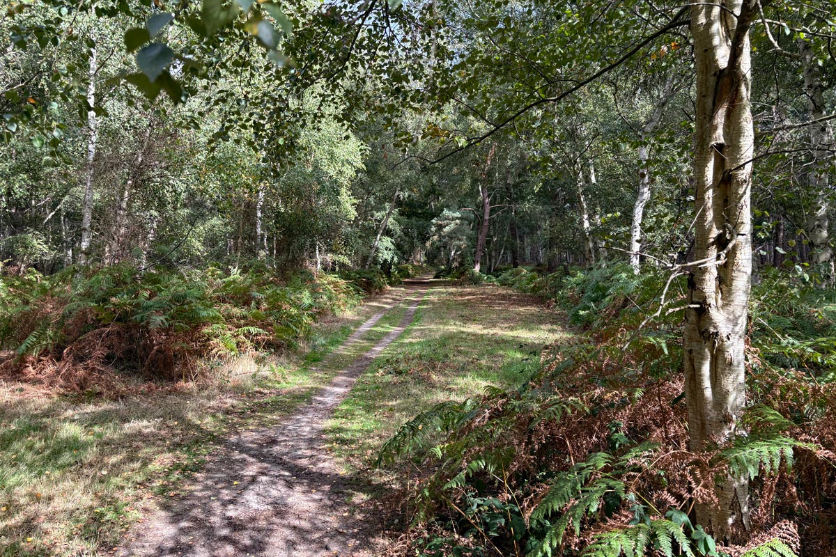 |
After the bridge there was more cross country walking to get back to the coast. This was partly on a new route through Snape Warren, which I had trouble navigating in spite of the new ECP signage, then a lovely walk through Black Heath Wood (stick to the path - private, private, private - to the left and right), and then a walk along the busy A1094; on the grass for part of it. I had to be in Aldeburgh by 16:45 to catch the last bus to Knodishall where I had booked accommodation. I had been unable to get a room at Aldeburgh as everything seemed to have been either fully booked or would have cost me several hundred pounds for the night. I missed out the walk round the Aldeburgh Marshes and got to Aldeburgh and caught my number 521 bus to Knodishall with two minutes to spare. Unfortunately I was not warned by my accommodation, The Butchers Arms, that the pub was closed on a Monday night, so there was no food. So I had to go to the village shop and buy something to eat back in my chalet.
End of day 3: About 16 miles of the path walked.
Day 4: From Aldeburgh to Walberswick.
Photos and details to follow.
End of day 4: About 14 wet miles of the path walked.
Day 5: From Walberswick to Lowestoft.
Photos and details to follow.
End of day 5: About 17 miles of the path walked.
Day 6: From Lowestoft to Great Yarmouth.
Photos and details to follow.
End of day 6: About 13 miles of the path walked.
Total 86 miles.
This makes a total of 1,429 miles walked so far on my English coast ramble.
All photos © rambleman.uk
Website © 2026 rambleman.uk